Zagora elevation
Zagora (Drâa-Tafilalet), Morocco elevation is 733 meters and Zagora elevation in feet is 2405 ft above sea level [src 1]. Zagora is a seat of a third-order administrative division (feature code) with elevation that is 117 meters (384 ft) bigger than average city elevation in Morocco.
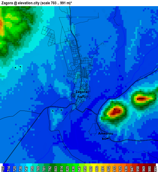
Below is the Elevation map of Zagora, which displays elevation range with different colors. Scale of the first map is from 703 to 991 m (2306 to 3251 ft) with average elevation of 737.3 meters (=2419 ft) [note 1]
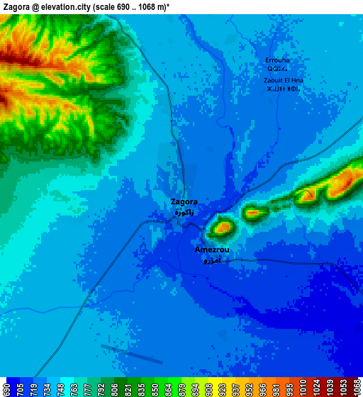
These maps also provides idea of topography and contour of this city, they are displayed at different zoom levels. More info about maps, scale and edge coordinates you can find below images.
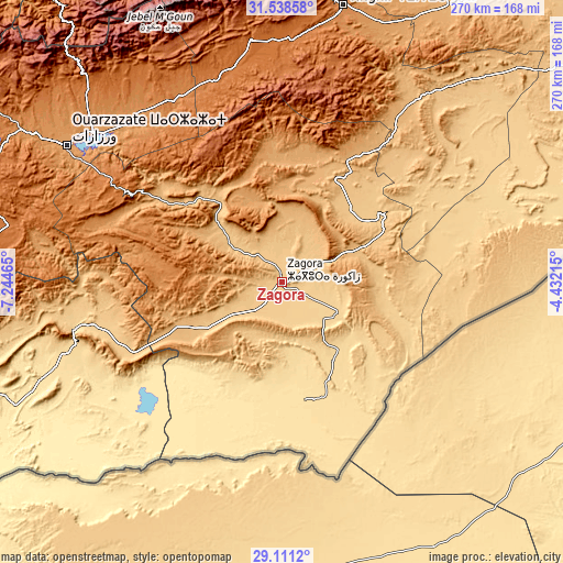
| \ | Map #1 | Map #2 | Topo.Map |
| Scale [m] | 703..991 m | 690..1068 m | × |
| Scale [ft] | 2306..3251 ft | 2264..3504 ft | × |
| Average | 737.3 m = 2419 ft | 754.6 m = 2476 ft | × |
| Width | 8.43 km = 5.2 mi | 16.87 km = 10.5 mi | 269.9 km = 167.7 mi |
| Height | 8.43 km = 5.2 mi | 16.87 km = 10.5 mi | 269.9 km = 167.7 mi |
| ↑Max Latitude | 30.370332° | 30.40824° | 31.53858° |
| Latitude at center | 30.33241° | 30.33241° | 30.33241° |
| ↓Min Latitude | 30.294473° | 30.256521° | 29.1112° |
| ← Min Longitude | -5.882345° | -5.926291° | -7.24465° |
| Longitude center | -5.8384° | -5.8384° | -5.8384° |
| →Max Longitude | -5.794455° | -5.750509° | -4.43215° |
Nearby cities:
Cities around Zagora sort by population:
• Ouarzazat elevation 1113 m
120.2 km,  302°
302°
• Tinghir 1281 m
134.7 km,  12°
12°
• Kelaat Mgouna 1431 m
105.4 km,  344°
344°
• Mhamid 550 m
58.1 km,  168°
168°
• Jebel Tiskaouine 1025 m
103.6 km,  41°
41°
• Tabant 1972 m
156.6 km, 339°
• Amerzgane 1321 m
153.2 km, 301°
• Taznakht 1405 m
133.7 km,  281°
281°
• Imider 1429 m
115.8 km,  2°
2°
• Alnif 871 m
107.8 km, 36°
• Skoura 1226 m
106.1 km,  319°
319°
• Agdz 940 m
70.7 km, 304°
Multilingual:
 En español:
Zagora elevación 733 m.
 En France:
Zagora élévation 733 m.


Sources and notes:
- [note 1] Map square and city borders are not equal. Map elevation data is calculated only from area inside that square.
- [src 1] Elevation data from geonames database provided with same terms of usage.
- [src 2] The elevation map of Zagora is generated using elevation data from NASA's 3 arcsec (90m) resolution SRTM data.
- [src 3] Base (background) map © OpenStreetMap contributors tiles are generated by Geofabrik and OpenTopoMap.
Copyright & License:
This Zagora Elevation Map is licensed under CC BY-SA. You may reuse any part from this page, if you give a proper credit by linking to this URL:
 More info on terms of use page.