Nommern elevation
Nommern (Mersch), Luxembourg elevation is 380 meters and Nommern elevation in feet is 1247 ft above sea level [src 1]. Nommern is a seat of a third-order administrative division (feature code) with elevation that is 92 meters (302 ft) bigger than average city elevation in Luxembourg.
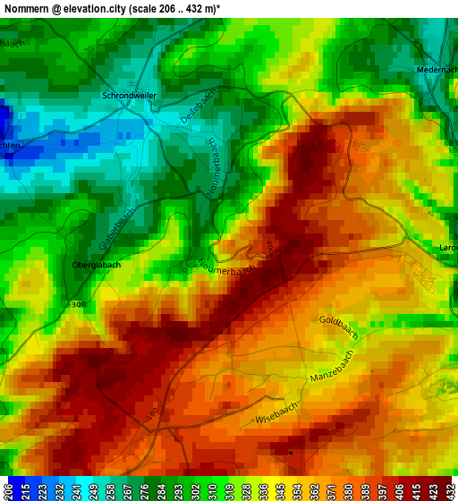
Below is the Elevation map of Nommern, which displays elevation range with different colors. Scale of the first map is from 206 to 432 m (676 to 1417 ft) with average elevation of 336.8 meters (=1105 ft) [note 1]
These maps also provides idea of topography and contour of this city, they are displayed at different zoom levels. More info about maps, scale and edge coordinates you can find below images.
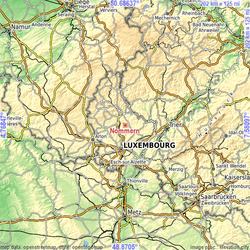
| \ | Map #1 | Topo.Map |
| Scale [m] | 206..432 m | × |
| Scale [ft] | 676..1417 ft | × |
| Average | 336.8 m = 1105 ft | × |
| Width | 6.31 km = 3.9 mi | 201.9 km = 125.5 mi |
| Height | 6.31 km = 3.9 mi | 201.9 km = 125.5 mi |
| ↑Max Latitude | 49.815304° | 50.68637° |
| Latitude at center | 49.78694° | 49.78694° |
| ↓Min Latitude | 49.758559° | 48.8705° |
| ← Min Longitude | 6.130775° | 4.76847° |
| Longitude center | 6.17472° | 6.17472° |
| →Max Longitude | 6.218665° | 7.58097° |
Nearby cities:
Cities around Nommern sort by population:
• Ettelbruck elevation 199 m
8.4 km,  323°
323°
• Mersch 219 m
6.5 km,  229°
229°
• Bissen 221 m
7.8 km,  270°
270°
• Colmar 237 m
6.1 km,  295°
295°
• Lintgen 230 m
7.9 km,  204°
204°
• Rollingen 227 m
6.6 km,  220°
220°
• Larochette 273 m
3.2 km,  96°
96°
• Schieren 213 m
7.3 km,  311°
311°
• Medernach 259 m
3.8 km,  49°
49°
• Heffingen 325 m
5.1 km,  112°
112°
• Waldbillig 298 m
7.9 km,  82°
82°
• Fischbach 317 m
4.6 km,  169°
169°
Multilingual:
 En español:
Nommern elevación 380 m.
 En France:
Nommern élévation 380 m.


Sources and notes:
- [note 1] Map square and city borders are not equal. Map elevation data is calculated only from area inside that square.
- [src 1] Elevation data from geonames database provided with same terms of usage.
- [src 2] The elevation map of Nommern is generated using elevation data from NASA's 3 arcsec (90m) resolution SRTM data.
- [src 3] Base (background) map © OpenStreetMap contributors tiles are generated by Geofabrik and OpenTopoMap.
Copyright & License:
This Nommern Elevation Map is licensed under CC BY-SA. You may reuse any part from this page, if you give a proper credit by linking to this URL:
 More info on terms of use page.