Smirnovo elevation
Smirnovo (Soltüstik Qazaqstan), Kazakhstan elevation is 135 meters and Smirnovo elevation in feet is 443 ft above sea level [src 1]. Smirnovo is a populated place (feature code) with elevation that is 223 meters (732 ft) smaller than average city elevation in Kazakhstan.
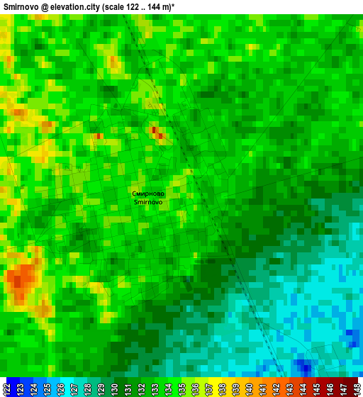
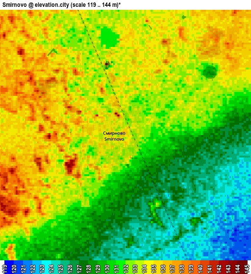
Below is the Elevation map of Smirnovo, which displays elevation range with different colors. Scale of the first map is from 122 to 144 m (400 to 472 ft) with average elevation of 132 meters (=433 ft) [note 1]
These maps also provides idea of topography and contour of this city, they are displayed at different zoom levels. More info about maps, scale and edge coordinates you can find below images.
| \ | Map #1 | Map #2 | Topo.Map |
| Scale [m] | 122..144 m | 119..144 m | × |
| Scale [ft] | 400..472 ft | 390..472 ft | × |
| Average | 132 m = 433 ft | 131.4 m = 431 ft | × |
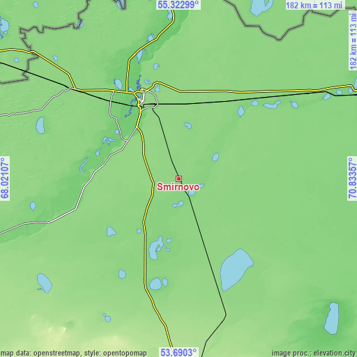
| Width | 5.67 km = 3.5 mi | 11.35 km = 7.1 mi | 181.5 km = 112.8 mi |
| Height | 5.67 km = 3.5 mi | 11.35 km = 7.1 mi | 181.5 km = 112.8 mi |
| ↑Max Latitude | 54.540302° | 54.565788° | 55.32299° |
| Latitude at center | 54.5148° | 54.5148° | 54.5148° |
| ↓Min Latitude | 54.489282° | 54.463748° | 53.6903° |
| ← Min Longitude | 69.383375° | 69.339429° | 68.02107° |
| Longitude center | 69.42732° | 69.42732° | 69.42732° |
| →Max Longitude | 69.471265° | 69.515211° | 70.83357° |
Nearby cities:
Cities around Smirnovo sort by population:
• Petropavl elevation 142 m
43 km,  335°
335°
• Kokshetau 234 m
136.9 km,  180°
180°
• Shchuchinsk 405 m
182.6 km,  164°
164°
• Akkol’ 261 m
136 km, 175°
• Taiynsha 155 m
77.4 km, 163°
• Bulayevo 130 m
78.3 km,  56°
56°
• Sergeyevka 149 m
149 km,  241°
241°
• Būrabay 321 m
169.4 km, 159°
• Bishkul 103 m
36 km,  324°
324°
• Yavlenka 132 m
65.5 km,  253°
253°
• Volodarskoye 297 m
161.1 km,  212°
212°
• Birlestik 234 m
125 km, 214°
Multilingual:
 En español:
Smirnovo elevación 135 m.
 En France:
Smirnovo élévation 135 m.
 Auf Deutsch:
Smirnovo höhe über dem Meeresspiegel ist 135 m.

Sources and notes:
- [note 1] Map square and city borders are not equal. Map elevation data is calculated only from area inside that square.
- [src 1] Elevation data from geonames database provided with same terms of usage.
- [src 2] The elevation map of Smirnovo is generated using elevation data from NASA's 3 arcsec (90m) resolution SRTM data.
- [src 3] Base (background) map © OpenStreetMap contributors tiles are generated by Geofabrik and OpenTopoMap.
Copyright & License:
This Smirnovo Elevation Map is licensed under CC BY-SA. You may reuse any part from this page, if you give a proper credit by linking to this URL:
 More info on terms of use page.