Kinzan elevation
Kinzan (Chungcheongnam-do), South Korea elevation is 160 meters and Kinzan elevation in feet is 525 ft above sea level [src 1]. Kinzan is a populated place (feature code) with elevation that is 88 meters (289 ft) bigger than average city elevation in South Korea.
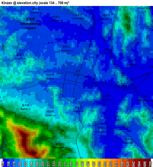
Below is the Elevation map of Kinzan, which displays elevation range with different colors. Scale of the first map is from 134 to 708 m (440 to 2323 ft) with average elevation of 212.7 meters (=698 ft) [note 1]
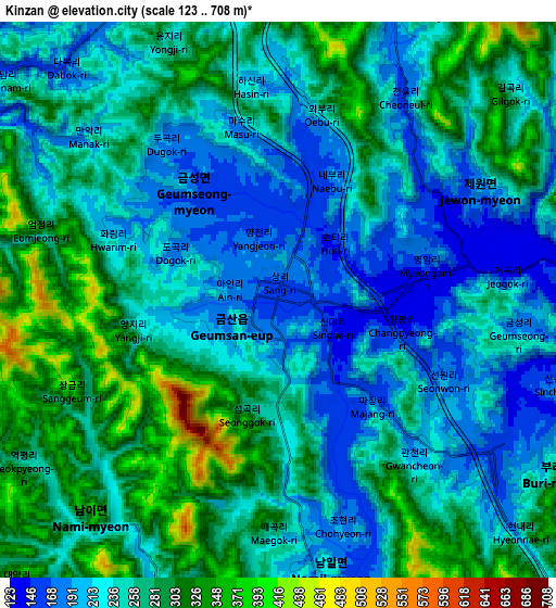
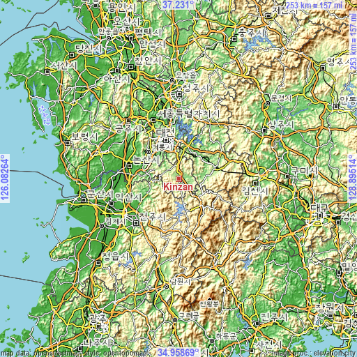
These maps also provides idea of topography and contour of this city, they are displayed at different zoom levels. More info about maps, scale and edge coordinates you can find below images.
| \ | Map #1 | Map #2 | Topo.Map |
| Scale [m] | 134..708 m | 123..708 m | × |
| Scale [ft] | 440..2323 ft | 404..2323 ft | × |
| Average | 212.7 m = 698 ft | 251.7 m = 826 ft | × |
| Width | 7.9 km = 4.9 mi | 15.79 km = 9.8 mi | 252.7 km = 157 mi |
| Height | 7.9 km = 4.9 mi | 15.79 km = 9.8 mi | 252.7 km = 157 mi |
| ↑Max Latitude | 36.138558° | 36.17404° | 37.231° |
| Latitude at center | 36.10306° | 36.10306° | 36.10306° |
| ↓Min Latitude | 36.067546° | 36.032016° | 34.95869° |
| ← Min Longitude | 127.444945° | 127.400999° | 126.08264° |
| Longitude center | 127.48889° | 127.48889° | 127.48889° |
| →Max Longitude | 127.532835° | 127.576781° | 128.89514° |
Nearby cities:
Cities around Kinzan sort by population:
• Daejeon elevation 46 m
28.9 km,  341°
341°
• Okcheon 97 m
23.1 km,  17°
17°
• Yeongdong 130 m
27 km,  72°
72°
• Annam 86 m
32.7 km,  30°
30°
• Yuseong 52 m
31.1 km,  333°
333°
• Jinjam 80 m
26.8 km,  324°
324°
• Simcheon 93 m
25.7 km,  54°
54°
• Gunbuk 104 m
25.6 km,  9°
9°
• Dongi 107 m
23.3 km, 30°
• Iwon 113 m
19.8 km,  36°
36°
• Gunseo 112 m
19.8 km, 9°
• Gunbuk 179 m
8 km, 25°
Multilingual:
 En español:
Kinzan elevación 160 m.
 En France:
Kinzan élévation 160 m.


Sources and notes:
- [note 1] Map square and city borders are not equal. Map elevation data is calculated only from area inside that square.
- [src 1] Elevation data from geonames database provided with same terms of usage.
- [src 2] The elevation map of Kinzan is generated using elevation data from NASA's 3 arcsec (90m) resolution SRTM data.
- [src 3] Base (background) map © OpenStreetMap contributors tiles are generated by Geofabrik and OpenTopoMap.
Copyright & License:
This Kinzan Elevation Map is licensed under CC BY-SA. You may reuse any part from this page, if you give a proper credit by linking to this URL:
 More info on terms of use page.