Daejeon elevation
Daejeon, South Korea elevation is 46 meters and Daejeon elevation in feet is 151 ft above sea level [src 1]. Daejeon is a seat of a first-order administrative division (feature code) with elevation that is 26 meters (85 ft) smaller than average city elevation in South Korea.
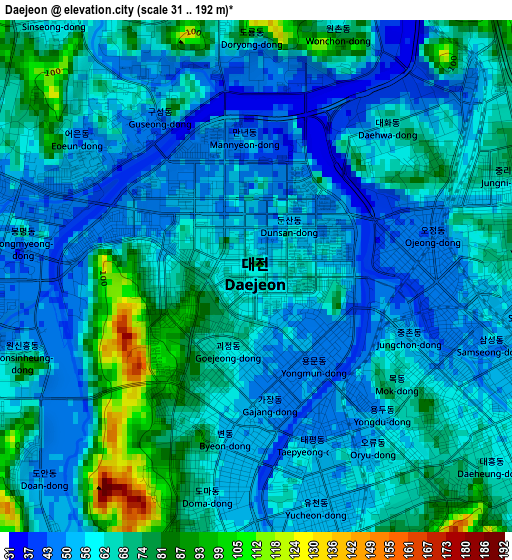
Below is the Elevation map of Daejeon, which displays elevation range with different colors. Scale of the first map is from 31 to 192 m (102 to 630 ft) with average elevation of 62.1 meters (=204 ft) [note 1]
These maps also provides idea of topography and contour of this city, they are displayed at different zoom levels. More info about maps, scale and edge coordinates you can find below images.
| \ | Map #1 | Map #2 | Topo.Map |
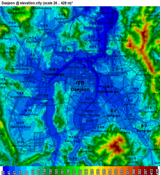
| Scale [m] | 31..192 m | 26..428 m | × |
| Scale [ft] | 102..630 ft | 85..1404 ft | × |
| Average | 62.1 m = 204 ft | 103.4 m = 339 ft | × |
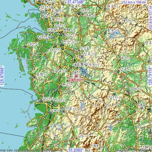
| Width | 7.87 km = 4.9 mi | 15.74 km = 9.8 mi | 251.9 km = 156.5 mi |
| Height | 7.87 km = 4.9 mi | 15.74 km = 9.8 mi | 251.9 km = 156.5 mi |
| ↑Max Latitude | 36.384516° | 36.419887° | 37.47348° |
| Latitude at center | 36.34913° | 36.34913° | 36.34913° |
| ↓Min Latitude | 36.313728° | 36.278309° | 35.2083° |
| ← Min Longitude | 127.340985° | 127.297039° | 125.97868° |
| Longitude center | 127.38493° | 127.38493° | 127.38493° |
| →Max Longitude | 127.428875° | 127.472821° | 128.79118° |
Nearby cities:
Cities around Daejeon sort by population:
• Okcheon elevation 97 m
17.2 km,  108°
108°
• Sintansin 40 m
12.3 km,  19°
19°
• Songgangdong 184 m
9.5 km,  355°
355°
• Gunbuk 179 m
23.9 km,  147°
147°
• Iwon 113 m
23.9 km,  118°
118°
• Sangwol 29 m
22.7 km,  254°
254°
• Dongi 107 m
22.2 km, 108°
• Hoenam 93 m
20.4 km,  58°
58°
• Gunseo 112 m
14.9 km, 121°
• Gunbuk 104 m
13.5 km,  98°
98°
• Jinjam 80 m
8.1 km,  228°
228°
• Yuseong 52 m
4.4 km,  276°
276°
Multilingual:
 En español:
Daejeon elevación 46 m.
 En France:
Daejeon élévation 46 m.


Sources and notes:
- [note 1] Map square and city borders are not equal. Map elevation data is calculated only from area inside that square.
- [src 1] Elevation data from geonames database provided with same terms of usage.
- [src 2] The elevation map of Daejeon is generated using elevation data from NASA's 3 arcsec (90m) resolution SRTM data.
- [src 3] Base (background) map © OpenStreetMap contributors tiles are generated by Geofabrik and OpenTopoMap.
Copyright & License:
This Daejeon Elevation Map is licensed under CC BY-SA. You may reuse any part from this page, if you give a proper credit by linking to this URL:
 More info on terms of use page.