Annaka elevation
Annaka (Gunma, Annaka Shi), Japan elevation is 170 meters and Annaka elevation in feet is 558 ft above sea level [src 1]. Annaka is a seat of a second-order administrative division (feature code) with elevation that is 85 meters (279 ft) bigger than average city elevation in Japan.
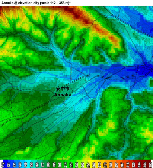
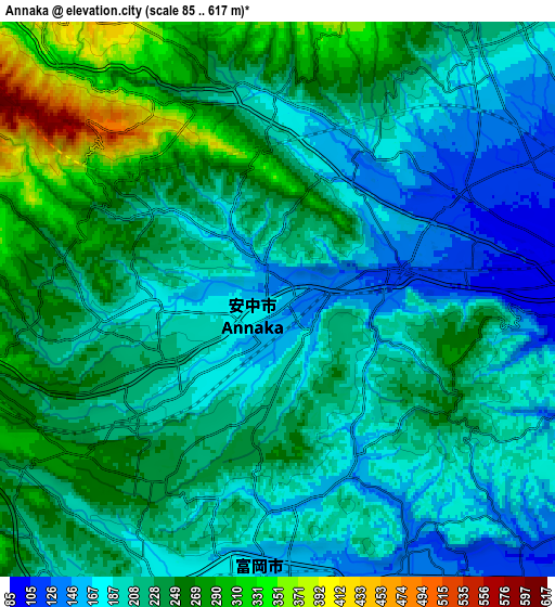
Below is the Elevation map of Annaka, which displays elevation range with different colors. Scale of the first map is from 112 to 353 m (367 to 1158 ft) with average elevation of 193.5 meters (=635 ft) [note 1]
These maps also provides idea of topography and contour of this city, they are displayed at different zoom levels. More info about maps, scale and edge coordinates you can find below images.
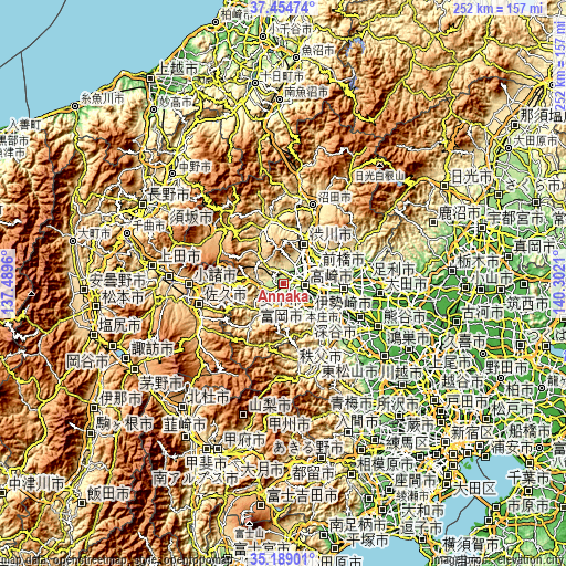
| \ | Map #1 | Map #2 | Topo.Map |
| Scale [m] | 112..353 m | 85..617 m | × |
| Scale [ft] | 367..1158 ft | 279..2024 ft | × |
| Average | 193.5 m = 635 ft | 219 m = 719 ft | × |
| Width | 7.87 km = 4.9 mi | 15.75 km = 9.8 mi | 251.9 km = 156.5 mi |
| Height | 7.87 km = 4.9 mi | 15.75 km = 9.8 mi | 251.9 km = 156.5 mi |
| ↑Max Latitude | 36.365505° | 36.400884° | 37.45474° |
| Latitude at center | 36.33011° | 36.33011° | 36.33011° |
| ↓Min Latitude | 36.294699° | 36.259272° | 35.18901° |
| ← Min Longitude | 138.851905° | 138.807959° | 137.4896° |
| Longitude center | 138.89585° | 138.89585° | 138.89585° |
| →Max Longitude | 138.939795° | 138.983741° | 140.3021° |
Nearby cities:
Cities around Annaka sort by population:
• Maebashi elevation 107 m
18.5 km,  65°
65°
• Takasaki 93 m
10.8 km,  88°
88°
• Isesaki 62 m
27.3 km, 93°
• Fujioka 94 m
18.3 km,  120°
120°
• Honjō 59 m
28.3 km,  111°
111°
• Tomioka 158 m
8.5 km,  178°
178°
• Shibukawa 202 m
19.4 km,  28°
28°
• Tamamura 68 m
20.1 km,  99°
99°
• Kanekomachi 193 m
12.7 km,  44°
44°
• Yoshii 125 m
11.9 km,  138°
138°
• Kodamachō-kodamaminami 106 m
26.6 km,  127°
127°
• Nakanojōmachi 371 m
29 km,  350°
350°
Multilingual:
 En español:
Annaka elevación 170 m.
 En France:
Annaka élévation 170 m.


Sources and notes:
- [note 1] Map square and city borders are not equal. Map elevation data is calculated only from area inside that square.
- [src 1] Elevation data from geonames database provided with same terms of usage.
- [src 2] The elevation map of Annaka is generated using elevation data from NASA's 3 arcsec (90m) resolution SRTM data.
- [src 3] Base (background) map © OpenStreetMap contributors tiles are generated by Geofabrik and OpenTopoMap.
Copyright & License:
This Annaka Elevation Map is licensed under CC BY-SA. You may reuse any part from this page, if you give a proper credit by linking to this URL:
 More info on terms of use page.