Fuji elevation
Fuji (Shizuoka, Fuji Shi), Japan elevation is 9 meters and Fuji elevation in feet is 30 ft above sea level [src 1]. Fuji is a seat of a second-order administrative division (feature code) with elevation that is 76 meters (249 ft) smaller than average city elevation in Japan.
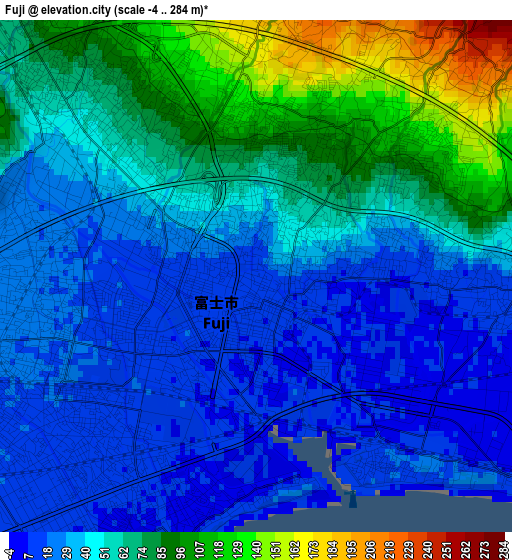
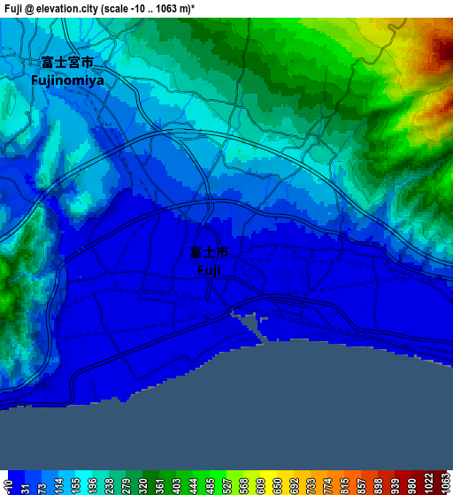
Below is the Elevation map of Fuji, which displays elevation range with different colors. Scale of the first map is from -4 to 284 m (-13 to 932 ft) with average elevation of 51.2 meters (=168 ft) [note 1]
These maps also provides idea of topography and contour of this city, they are displayed at different zoom levels. More info about maps, scale and edge coordinates you can find below images.
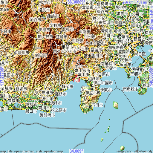
| \ | Map #1 | Map #2 | Topo.Map |
| Scale [m] | -4..284 m | -10..1063 m | × |
| Scale [ft] | -13..932 ft | -33..3488 ft | × |
| Average | 51.2 m = 168 ft | 165.2 m = 542 ft | × |
| Width | 7.99 km = 5 mi | 15.98 km = 9.9 mi | 255.6 km = 158.8 mi |
| Height | 7.99 km = 5 mi | 15.98 km = 9.9 mi | 255.6 km = 158.8 mi |
| ↑Max Latitude | 35.202586° | 35.238487° | 36.30809° |
| Latitude at center | 35.16667° | 35.16667° | 35.16667° |
| ↓Min Latitude | 35.130738° | 35.094789° | 34.009° |
| ← Min Longitude | 138.639385° | 138.595439° | 137.27708° |
| Longitude center | 138.68333° | 138.68333° | 138.68333° |
| →Max Longitude | 138.727275° | 138.771221° | 140.08958° |
Nearby cities:
Cities around Fuji sort by population:
• Shizuoka elevation 23 m
34.1 km,  233°
233°
• Numazu 8 m
18.2 km,  113°
113°
• Fujinomiya 116 m
8.2 km,  312°
312°
• Mishima 24 m
21.9 km,  104°
104°
• Gotenba 446 m
29 km,  54°
54°
• Fujiyoshida 1055 m
32.1 km,  18°
18°
• Atami 230 m
34.7 km, 104°
• Hakone 734 m
31.3 km,  85°
85°
• Heda 171 m
24.5 km,  157°
157°
• Izu 55 m
32.3 km,  132°
132°
• Izunokuni 17 m
28.2 km,  120°
120°
• Susono 133 m
20.3 km, 87°
Multilingual:
 En español:
Fuji elevación 9 m.
 En France:
Fuji élévation 9 m.


Sources and notes:
- [note 1] Map square and city borders are not equal. Map elevation data is calculated only from area inside that square.
- [src 1] Elevation data from geonames database provided with same terms of usage.
- [src 2] The elevation map of Fuji is generated using elevation data from NASA's 3 arcsec (90m) resolution SRTM data.
- [src 3] Base (background) map © OpenStreetMap contributors tiles are generated by Geofabrik and OpenTopoMap.
Copyright & License:
This Fuji Elevation Map is licensed under CC BY-SA. You may reuse any part from this page, if you give a proper credit by linking to this URL:
 More info on terms of use page.