Miyazu elevation
Miyazu (Kyoto, Miyazu-shi), Japan elevation is 146 meters and Miyazu elevation in feet is 479 ft above sea level [src 1]. Miyazu is a seat of a second-order administrative division (feature code) with elevation that is 61 meters (200 ft) bigger than average city elevation in Japan.
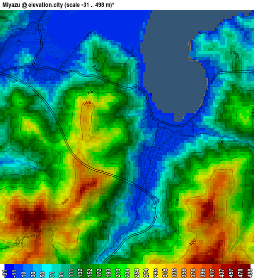
Below is the Elevation map of Miyazu, which displays elevation range with different colors. Scale of the first map is from -31 to 498 m (-102 to 1634 ft) with average elevation of 155.5 meters (=510 ft) [note 1]
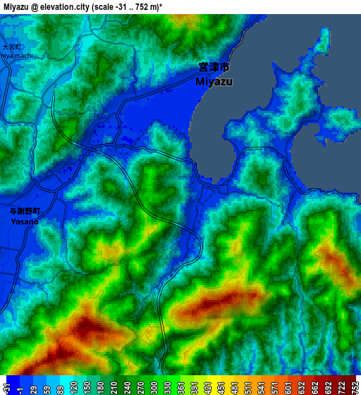
These maps also provides idea of topography and contour of this city, they are displayed at different zoom levels. More info about maps, scale and edge coordinates you can find below images.
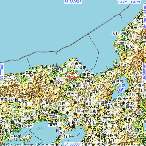
| \ | Map #1 | Map #2 | Topo.Map |
| Scale [m] | -31..498 m | -31..752 m | × |
| Scale [ft] | -102..1634 ft | -102..2467 ft | × |
| Average | 155.5 m = 510 ft | 185.5 m = 609 ft | × |
| Width | 7.95 km = 4.9 mi | 15.91 km = 9.9 mi | 254.5 km = 158.1 mi |
| Height | 7.95 km = 4.9 mi | 15.91 km = 9.9 mi | 254.5 km = 158.1 mi |
| ↑Max Latitude | 35.569084° | 35.604822° | 36.66951° |
| Latitude at center | 35.53333° | 35.53333° | 35.53333° |
| ↓Min Latitude | 35.49756° | 35.461775° | 34.38083° |
| ← Min Longitude | 135.139385° | 135.095439° | 133.77708° |
| Longitude center | 135.18333° | 135.18333° | 135.18333° |
| →Max Longitude | 135.227275° | 135.271221° | 136.58958° |
Nearby cities:
Cities around Miyazu sort by population:
• Maizuru elevation 6 m
16.4 km,  124°
124°
• Fukuchiyama 20 m
26.6 km,  193°
193°
• Sasayama 202 m
52 km,  176°
176°
• Toyooka 29 m
32.8 km,  271°
271°
• Ayabe 46 m
26.6 km,  166°
166°
• Nishiwaki 57 m
63.9 km,  197°
197°
• Obama 3 m
51.1 km,  94°
94°
• Nantan 248 m
54.8 km,  149°
149°
• Asago 125 m
45.3 km,  227°
227°
• Tanba 91 m
43.5 km, 197°
• Yabu 40 m
40 km,  248°
248°
• Kyōtango 61 m
15 km,  302°
302°
Multilingual:
 En español:
Miyazu elevación 146 m.
 En France:
Miyazu élévation 146 m.


Sources and notes:
- [note 1] Map square and city borders are not equal. Map elevation data is calculated only from area inside that square.
- [src 1] Elevation data from geonames database provided with same terms of usage.
- [src 2] The elevation map of Miyazu is generated using elevation data from NASA's 3 arcsec (90m) resolution SRTM data.
- [src 3] Base (background) map © OpenStreetMap contributors tiles are generated by Geofabrik and OpenTopoMap.
Copyright & License:
This Miyazu Elevation Map is licensed under CC BY-SA. You may reuse any part from this page, if you give a proper credit by linking to this URL:
 More info on terms of use page.