Morohongō elevation
Morohongō (Saitama, Iruma-gun), Japan elevation is 125 meters and Morohongō elevation in feet is 410 ft above sea level [src 1]. Morohongō is a populated place (feature code) with elevation that is 40 meters (131 ft) bigger than average city elevation in Japan.
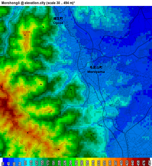
Below is the Elevation map of Morohongō, which displays elevation range with different colors. Scale of the first map is from 30 to 494 m (98 to 1621 ft) with average elevation of 150.5 meters (=494 ft) [note 1]
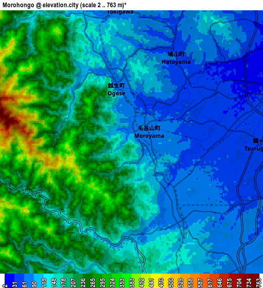
These maps also provides idea of topography and contour of this city, they are displayed at different zoom levels. More info about maps, scale and edge coordinates you can find below images.
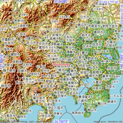
| \ | Map #1 | Map #2 | Topo.Map |
| Scale [m] | 30..494 m | 2..763 m | × |
| Scale [ft] | 98..1621 ft | 7..2503 ft | × |
| Average | 150.5 m = 494 ft | 163 m = 535 ft | × |
| Width | 7.91 km = 4.9 mi | 15.83 km = 9.8 mi | 253.2 km = 157.3 mi |
| Height | 7.91 km = 4.9 mi | 15.83 km = 9.8 mi | 253.2 km = 157.3 mi |
| ↑Max Latitude | 35.971134° | 36.006691° | 37.06593° |
| Latitude at center | 35.93556° | 35.93556° | 35.93556° |
| ↓Min Latitude | 35.89997° | 35.864365° | 34.78879° |
| ← Min Longitude | 139.260495° | 139.216549° | 137.89819° |
| Longitude center | 139.30444° | 139.30444° | 139.30444° |
| →Max Longitude | 139.348385° | 139.392331° | 140.71069° |
Nearby cities:
Cities around Morohongō sort by population:
• Kawagoe elevation 26 m
16.6 km,  100°
100°
• Sayama 81 m
13.4 km,  133°
133°
• Ōme 189 m
17.7 km,  198°
198°
• Sakado 33 m
8 km,  72°
72°
• Hannō 113 m
9.4 km,  172°
172°
• Kamifukuoka 25 m
20.1 km,  110°
110°
• Ogawa 90 m
13.6 km,  345°
345°
• Hamura 154 m
19.3 km,  175°
175°
• Higashi-Matsuyama 20 m
14.8 km,  42°
42°
• Iruma 126 m
14.3 km,  156°
156°
• Tsurugashima 33 m
9.3 km, 72°
• Hidaka 56 m
5.6 km, 111°
Multilingual:
 En español:
Morohongō elevación 125 m.
 En France:
Morohongō élévation 125 m.
 Auf Deutsch:
Morohongō höhe über dem Meeresspiegel ist 125 m.

Sources and notes:
- [note 1] Map square and city borders are not equal. Map elevation data is calculated only from area inside that square.
- [src 1] Elevation data from geonames database provided with same terms of usage.
- [src 2] The elevation map of Morohongō is generated using elevation data from NASA's 3 arcsec (90m) resolution SRTM data.
- [src 3] Base (background) map © OpenStreetMap contributors tiles are generated by Geofabrik and OpenTopoMap.
Copyright & License:
This Morohongō Elevation Map is licensed under CC BY-SA. You may reuse any part from this page, if you give a proper credit by linking to this URL:
 More info on terms of use page.