Nabari elevation
Nabari (Mie, Nabari-shi), Japan elevation is 192 meters and Nabari elevation in feet is 630 ft above sea level [src 1]. Nabari is a seat of a second-order administrative division (feature code) with elevation that is 107 meters (351 ft) bigger than average city elevation in Japan.
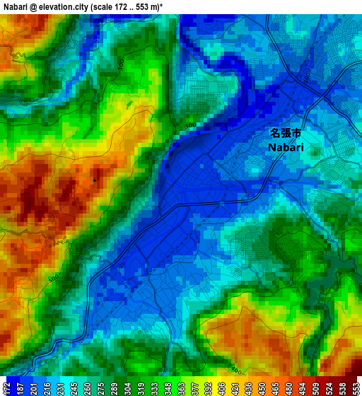
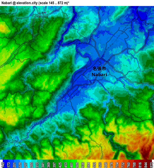
Below is the Elevation map of Nabari, which displays elevation range with different colors. Scale of the first map is from 172 to 553 m (564 to 1814 ft) with average elevation of 296.2 meters (=972 ft) [note 1]
These maps also provides idea of topography and contour of this city, they are displayed at different zoom levels. More info about maps, scale and edge coordinates you can find below images.
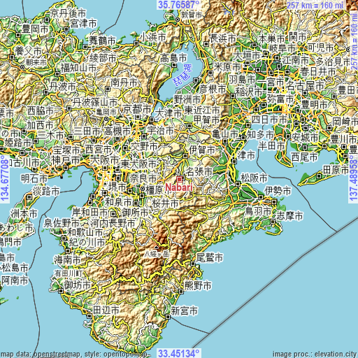
| \ | Map #1 | Map #2 | Topo.Map |
| Scale [m] | 172..553 m | 145..872 m | × |
| Scale [ft] | 564..1814 ft | 476..2861 ft | × |
| Average | 296.2 m = 972 ft | 364 m = 1194 ft | × |
| Width | 8.04 km = 5 mi | 16.09 km = 10 mi | 257.4 km = 159.9 mi |
| Height | 8.04 km = 5 mi | 16.09 km = 10 mi | 257.4 km = 159.9 mi |
| ↑Max Latitude | 34.652828° | 34.68897° | 35.76587° |
| Latitude at center | 34.61667° | 34.61667° | 34.61667° |
| ↓Min Latitude | 34.580496° | 34.544307° | 33.45134° |
| ← Min Longitude | 136.039385° | 135.995439° | 134.67708° |
| Longitude center | 136.08333° | 136.08333° | 136.08333° |
| →Max Longitude | 136.127275° | 136.171221° | 137.48958° |
Nearby cities:
Cities around Nabari sort by population:
• Nara-shi elevation 68 m
26.6 km,  286°
286°
• Kashihara-shi 65 m
29.2 km,  245°
245°
• Tenri 56 m
23.2 km,  260°
260°
• Sakurai 108 m
25 km,  238°
238°
• Ueno-ebisumachi 149 m
16.4 km,  15°
15°
• Tawaramoto 48 m
27.5 km, 255°
• Hōryūji 49 m
31.6 km,  269°
269°
• Haibara-akanedai 345 m
15.3 km,  232°
232°
• Yamatokōriyama 42 m
28.7 km, 267°
• Kizugawa 56 m
25.9 km,  300°
300°
• Ōuda 372 m
21.6 km,  219°
219°
• Iga 152 m
16.4 km, 16°
Multilingual:
 En español:
Nabari elevación 192 m.
 En France:
Nabari élévation 192 m.


Sources and notes:
- [note 1] Map square and city borders are not equal. Map elevation data is calculated only from area inside that square.
- [src 1] Elevation data from geonames database provided with same terms of usage.
- [src 2] The elevation map of Nabari is generated using elevation data from NASA's 3 arcsec (90m) resolution SRTM data.
- [src 3] Base (background) map © OpenStreetMap contributors tiles are generated by Geofabrik and OpenTopoMap.
Copyright & License:
This Nabari Elevation Map is licensed under CC BY-SA. You may reuse any part from this page, if you give a proper credit by linking to this URL:
 More info on terms of use page.