Oyama elevation
Oyama (Tochigi, Oyama-shi), Japan elevation is 41 meters and Oyama elevation in feet is 135 ft above sea level [src 1]. Oyama is a seat of a second-order administrative division (feature code) with elevation that is 44 meters (144 ft) smaller than average city elevation in Japan.
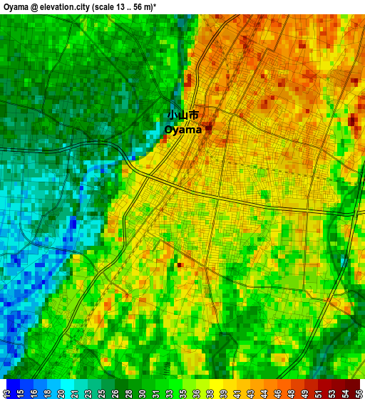
Below is the Elevation map of Oyama, which displays elevation range with different colors. Scale of the first map is from 13 to 56 m (43 to 184 ft) with average elevation of 33.9 meters (=111 ft) [note 1]
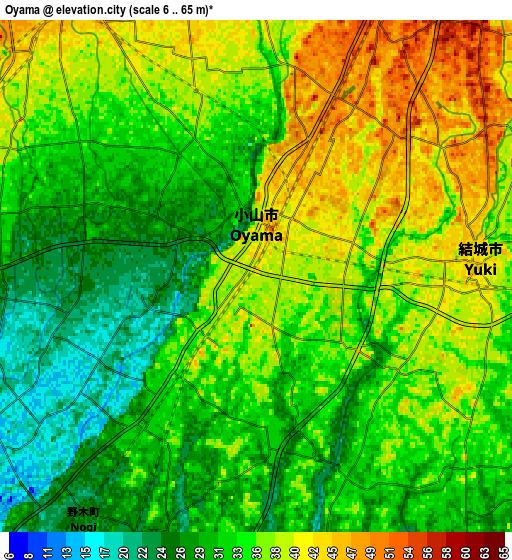
These maps also provides idea of topography and contour of this city, they are displayed at different zoom levels. More info about maps, scale and edge coordinates you can find below images.
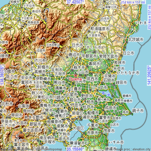
| \ | Map #1 | Map #2 | Topo.Map |
| Scale [m] | 13..56 m | 6..65 m | × |
| Scale [ft] | 43..184 ft | 20..213 ft | × |
| Average | 33.9 m = 111 ft | 34.3 m = 113 ft | × |
| Width | 7.88 km = 4.9 mi | 15.75 km = 9.8 mi | 252 km = 156.6 mi |
| Height | 7.88 km = 4.9 mi | 15.75 km = 9.8 mi | 252 km = 156.6 mi |
| ↑Max Latitude | 36.335409° | 36.370801° | 37.42507° |
| Latitude at center | 36.3° | 36.3° | 36.3° |
| ↓Min Latitude | 36.264575° | 36.229134° | 35.15846° |
| ← Min Longitude | 139.756055° | 139.712109° | 138.39375° |
| Longitude center | 139.8° | 139.8° | 139.8° |
| →Max Longitude | 139.843945° | 139.887891° | 141.20625° |
Nearby cities:
Cities around Oyama sort by population:
• Sano elevation 36 m
19.5 km,  275°
275°
• Tochigi 51 m
11 km,  327°
327°
• Shimodate 34 m
16.4 km,  90°
90°
• Koga 17 m
15 km,  209°
209°
• Yūki 40 m
7.5 km, 90°
• Mibu 59 m
13 km,  0°
0°
• Kaminokawa 65 m
18.1 km,  35°
35°
• Kurihashi 14 m
20.6 km, 205°
• Fujioka 21 m
14.5 km,  247°
247°
• Shimo-tsuma 28 m
19.8 km,  130°
130°
• Chikusei 33 m
16.4 km,  83°
83°
• Shimotsuke 66 m
13.9 km,  25°
25°
Multilingual:
 En español:
Oyama elevación 41 m.
 En France:
Oyama élévation 41 m.


Sources and notes:
- [note 1] Map square and city borders are not equal. Map elevation data is calculated only from area inside that square.
- [src 1] Elevation data from geonames database provided with same terms of usage.
- [src 2] The elevation map of Oyama is generated using elevation data from NASA's 3 arcsec (90m) resolution SRTM data.
- [src 3] Base (background) map © OpenStreetMap contributors tiles are generated by Geofabrik and OpenTopoMap.
Copyright & License:
This Oyama Elevation Map is licensed under CC BY-SA. You may reuse any part from this page, if you give a proper credit by linking to this URL:
 More info on terms of use page.