Saku elevation
Saku (Nagano, Saku Shi), Japan elevation is 684 meters and Saku elevation in feet is 2244 ft above sea level [src 1]. Saku is a seat of a second-order administrative division (feature code) with elevation that is 599 meters (1965 ft) bigger than average city elevation in Japan.
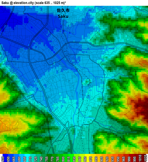
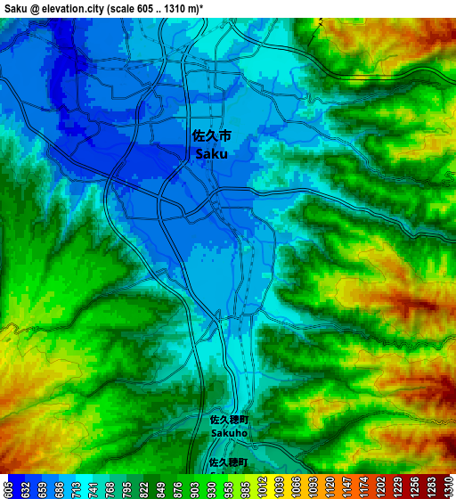
Below is the Elevation map of Saku, which displays elevation range with different colors. Scale of the first map is from 635 to 1025 m (2083 to 3363 ft) with average elevation of 737.3 meters (=2419 ft) [note 1]
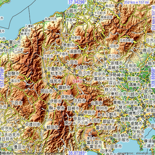
These maps also provides idea of topography and contour of this city, they are displayed at different zoom levels. More info about maps, scale and edge coordinates you can find below images.
| \ | Map #1 | Map #2 | Topo.Map |
| Scale [m] | 635..1025 m | 605..1310 m | × |
| Scale [ft] | 2083..3363 ft | 1985..4298 ft | × |
| Average | 737.3 m = 2419 ft | 833.6 m = 2735 ft | × |
| Width | 7.88 km = 4.9 mi | 15.77 km = 9.8 mi | 252.3 km = 156.8 mi |
| Height | 7.88 km = 4.9 mi | 15.77 km = 9.8 mi | 252.3 km = 156.8 mi |
| ↑Max Latitude | 36.252117° | 36.287547° | 37.34296° |
| Latitude at center | 36.21667° | 36.21667° | 36.21667° |
| ↓Min Latitude | 36.181207° | 36.145729° | 35.07393° |
| ← Min Longitude | 138.439385° | 138.395439° | 137.07708° |
| Longitude center | 138.48333° | 138.48333° | 138.48333° |
| →Max Longitude | 138.527275° | 138.571221° | 139.88958° |
Nearby cities:
Cities around Saku sort by population:
• Matsumoto elevation 593 m
46.4 km,  272°
272°
• Ueda 536 m
27.5 km,  318°
318°
• Chino 801 m
38.5 km,  230°
230°
• Suwa 762 m
38.7 km,  239°
239°
• Okaya 773 m
43.2 km,  245°
245°
• Tomioka 158 m
37.4 km,  83°
83°
• Annaka 170 m
39.1 km,  71°
71°
• Komoro 686 m
12 km,  338°
338°
• Hokuto 715 m
43.2 km,  190°
190°
• Yoshii 125 m
45 km,  85°
85°
• Kamimaruko 563 m
22 km,  301°
301°
• Tōmi 639 m
19 km, 324°
Multilingual:
 En español:
Saku elevación 684 m.
 En France:
Saku élévation 684 m.


Sources and notes:
- [note 1] Map square and city borders are not equal. Map elevation data is calculated only from area inside that square.
- [src 1] Elevation data from geonames database provided with same terms of usage.
- [src 2] The elevation map of Saku is generated using elevation data from NASA's 3 arcsec (90m) resolution SRTM data.
- [src 3] Base (background) map © OpenStreetMap contributors tiles are generated by Geofabrik and OpenTopoMap.
Copyright & License:
This Saku Elevation Map is licensed under CC BY-SA. You may reuse any part from this page, if you give a proper credit by linking to this URL:
 More info on terms of use page.