Shinshiro elevation
Shinshiro (Aichi, Shinshiro-shi), Japan elevation is 48 meters and Shinshiro elevation in feet is 157 ft above sea level [src 1]. Shinshiro is a seat of a second-order administrative division (feature code) with elevation that is 37 meters (121 ft) smaller than average city elevation in Japan.
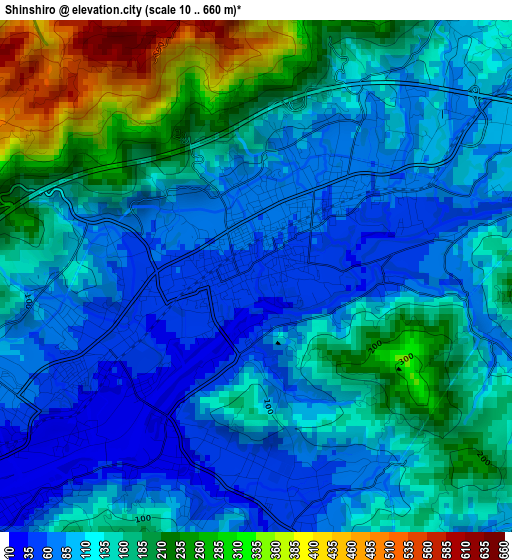
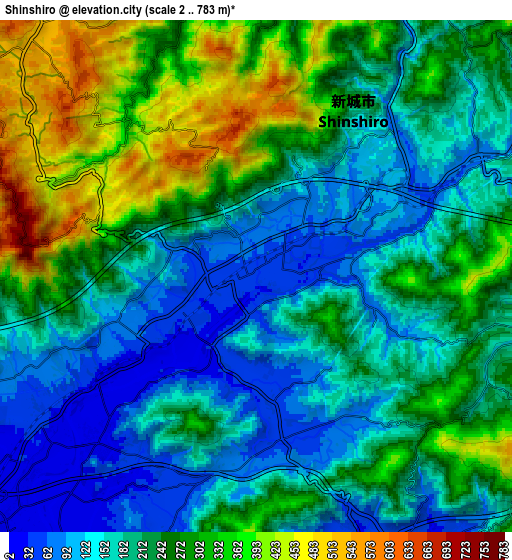
Below is the Elevation map of Shinshiro, which displays elevation range with different colors. Scale of the first map is from 10 to 660 m (33 to 2165 ft) with average elevation of 141.7 meters (=465 ft) [note 1]
These maps also provides idea of topography and contour of this city, they are displayed at different zoom levels. More info about maps, scale and edge coordinates you can find below images.
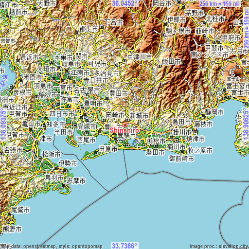
| \ | Map #1 | Map #2 | Topo.Map |
| Scale [m] | 10..660 m | 2..783 m | × |
| Scale [ft] | 33..2165 ft | 7..2569 ft | × |
| Average | 141.7 m = 465 ft | 227.1 m = 745 ft | × |
| Width | 8.01 km = 5 mi | 16.03 km = 10 mi | 256.5 km = 159.4 mi |
| Height | 8.01 km = 5 mi | 16.03 km = 10 mi | 256.5 km = 159.4 mi |
| ↑Max Latitude | 34.936034° | 34.972052° | 36.0452° |
| Latitude at center | 34.9° | 34.9° | 34.9° |
| ↓Min Latitude | 34.86395° | 34.827885° | 33.7386° |
| ← Min Longitude | 137.456055° | 137.412109° | 136.09375° |
| Longitude center | 137.5° | 137.5° | 137.5° |
| →Max Longitude | 137.543945° | 137.587891° | 138.90625° |
Nearby cities:
Cities around Shinshiro sort by population:
• Hamamatsu elevation 3 m
30.8 km,  136°
136°
• Toyohashi 12 m
18.3 km,  215°
215°
• Toyota 55 m
37.8 km,  302°
302°
• Okazaki 34 m
30.9 km,  280°
280°
• Anjō 20 m
38.8 km, 279°
• Toyokawa 4 m
13 km, 224°
• Iwata 5 m
38.9 km,  124°
124°
• Hamakita 21 m
28.1 km,  113°
113°
• Gamagōri 23 m
25.4 km,  253°
253°
• Tahara 6 m
33.6 km, 219°
• Kozakai-chō 7 m
17 km,  229°
229°
• Kosai 30 m
22.3 km,  174°
174°
Multilingual:
 En español:
Shinshiro elevación 48 m.
 En France:
Shinshiro élévation 48 m.
 Auf Deutsch:
Shinshiro höhe über dem Meeresspiegel ist 48 m.

Sources and notes:
- [note 1] Map square and city borders are not equal. Map elevation data is calculated only from area inside that square.
- [src 1] Elevation data from geonames database provided with same terms of usage.
- [src 2] The elevation map of Shinshiro is generated using elevation data from NASA's 3 arcsec (90m) resolution SRTM data.
- [src 3] Base (background) map © OpenStreetMap contributors tiles are generated by Geofabrik and OpenTopoMap.
Copyright & License:
This Shinshiro Elevation Map is licensed under CC BY-SA. You may reuse any part from this page, if you give a proper credit by linking to this URL:
 More info on terms of use page.