Takedamachi elevation
Takedamachi (Oita, Taketa-shi), Japan elevation is 262 meters and Takedamachi elevation in feet is 860 ft above sea level [src 1]. Takedamachi is a section of populated place (feature code) with elevation that is 177 meters (581 ft) bigger than average city elevation in Japan.
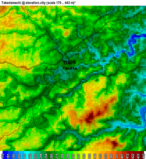
Below is the Elevation map of Takedamachi, which displays elevation range with different colors. Scale of the first map is from 170 to 443 m (558 to 1453 ft) with average elevation of 287.7 meters (=944 ft) [note 1]
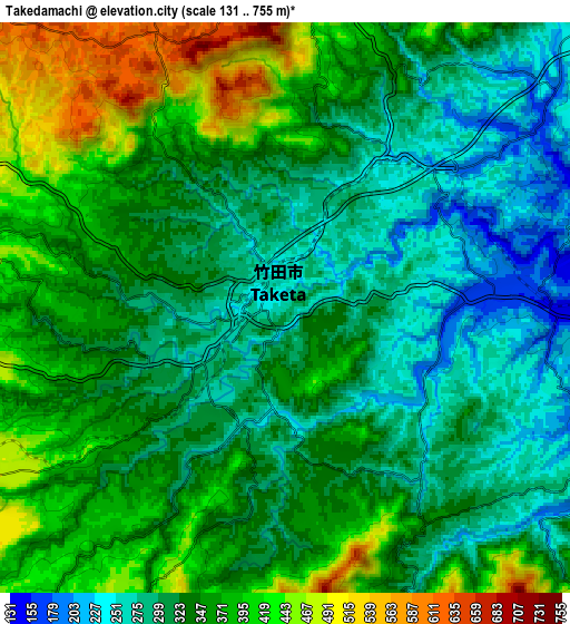
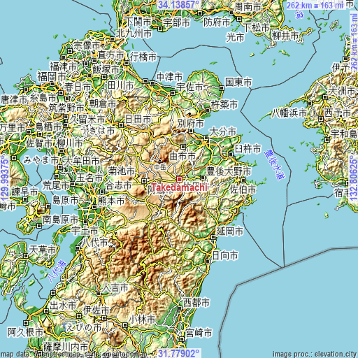
These maps also provides idea of topography and contour of this city, they are displayed at different zoom levels. More info about maps, scale and edge coordinates you can find below images.
| \ | Map #1 | Map #2 | Topo.Map |
| Scale [m] | 170..443 m | 131..755 m | × |
| Scale [ft] | 558..1453 ft | 430..2477 ft | × |
| Average | 287.7 m = 944 ft | 340.7 m = 1118 ft | × |
| Width | 8.2 km = 5.1 mi | 16.4 km = 10.2 mi | 262.4 km = 163 mi |
| Height | 8.2 km = 5.1 mi | 16.4 km = 10.2 mi | 262.4 km = 163 mi |
| ↑Max Latitude | 33.003532° | 33.040378° | 34.13857° |
| Latitude at center | 32.96667° | 32.96667° | 32.96667° |
| ↓Min Latitude | 32.929793° | 32.8929° | 31.77902° |
| ← Min Longitude | 131.356055° | 131.312109° | 129.99375° |
| Longitude center | 131.4° | 131.4° | 131.4° |
| →Max Longitude | 131.443945° | 131.487891° | 132.80625° |
Nearby cities:
Cities around Takedamachi sort by population:
• Ōita elevation 9 m
35 km,  32°
32°
• Beppu 22 m
35.9 km,  14°
14°
• Tsurusaki 5 m
41.2 km,  41°
41°
• Saiki 3 m
46.7 km,  92°
92°
• Usuki 4 m
41.5 km,  65°
65°
• Aso 520 m
30 km,  263°
263°
• Hiji 23 m
46.5 km,  15°
15°
• Tsukumiura 13 m
45.4 km, 74°
• Tsukawaki 336 m
41.3 km,  326°
326°
• Yufu 421 m
25.5 km,  355°
355°
• Bungo-ōno 206 m
12 km, 87°
• Taketa 311 m
3.2 km, 255°
Multilingual:
 En español:
Takedamachi elevación 262 m.
 En France:
Takedamachi élévation 262 m.
 Auf Deutsch:
Takedamachi höhe über dem Meeresspiegel ist 262 m.

Sources and notes:
- [note 1] Map square and city borders are not equal. Map elevation data is calculated only from area inside that square.
- [src 1] Elevation data from geonames database provided with same terms of usage.
- [src 2] The elevation map of Takedamachi is generated using elevation data from NASA's 3 arcsec (90m) resolution SRTM data.
- [src 3] Base (background) map © OpenStreetMap contributors tiles are generated by Geofabrik and OpenTopoMap.
Copyright & License:
This Takedamachi Elevation Map is licensed under CC BY-SA. You may reuse any part from this page, if you give a proper credit by linking to this URL:
 More info on terms of use page.