Villanuova elevation
Villanuova (Lombardy, Provincia di Bergamo), Italy elevation is 93 meters and Villanuova elevation in feet is 305 ft above sea level [src 1]. Villanuova is a seat of a third-order administrative division (feature code) with elevation that is 229 meters (751 ft) smaller than average city elevation in Italy.
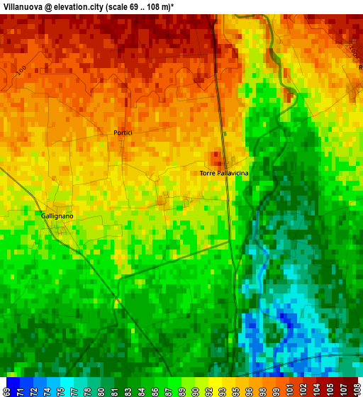
Below is the Elevation map of Villanuova, which displays elevation range with different colors. Scale of the first map is from 69 to 108 m (226 to 354 ft) with average elevation of 89.7 meters (=294 ft) [note 1]
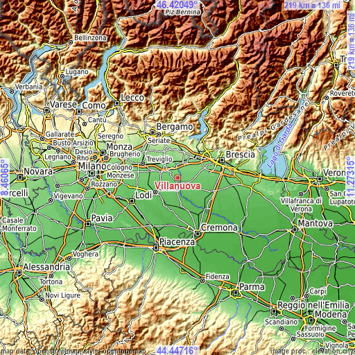
These maps also provides idea of topography and contour of this city, they are displayed at different zoom levels. More info about maps, scale and edge coordinates you can find below images.
| \ | Map #1 | Topo.Map |
| Scale [m] | 69..108 m | × |
| Scale [ft] | 226..354 ft | × |
| Average | 89.7 m = 294 ft | × |
| Width | 6.86 km = 4.3 mi | 219.4 km = 136.3 mi |
| Height | 6.86 km = 4.3 mi | 219.4 km = 136.3 mi |
| ↑Max Latitude | 45.473275° | 46.42049° |
| Latitude at center | 45.44245° | 45.44245° |
| ↓Min Latitude | 45.411608° | 44.44716° |
| ← Min Longitude | 9.822955° | 8.46065° |
| Longitude center | 9.8669° | 9.8669° |
| →Max Longitude | 9.910845° | 11.27315° |
Nearby cities:
Cities around Villanuova sort by population:
• Orzinuovi elevation 88 m
6.3 km,  135°
135°
• Rudiano 115 m
5.4 km,  15°
15°
• Soncino 81 m
4.7 km,  178°
178°
• Calcio 124 m
7.4 km,  349°
349°
• Fontanella 105 m
5.8 km,  300°
300°
• Cizzago-Comezzano 102 m
7.7 km,  67°
67°
• Roccafranca 102 m
4.3 km,  56°
56°
• Pumenengo 109 m
4.2 km,  0°
0°
• Ludriano 95 m
5.2 km,  82°
82°
• Torre Pallavicina 98 m
0.9 km, 61°
• Casaletto di Sopra 88 m
7.1 km,  248°
248°
• Cizzago 103 m
7.2 km, 63°
Multilingual:
 En español:
Villanuova elevación 93 m.
 En France:
Villanuova élévation 93 m.
 Auf Deutsch:
Villanuova höhe über dem Meeresspiegel ist 93 m.

Sources and notes:
- [note 1] Map square and city borders are not equal. Map elevation data is calculated only from area inside that square.
- [src 1] Elevation data from geonames database provided with same terms of usage.
- [src 2] The elevation map of Villanuova is generated using elevation data from NASA's 3 arcsec (90m) resolution SRTM data.
- [src 3] Base (background) map © OpenStreetMap contributors tiles are generated by Geofabrik and OpenTopoMap.
Copyright & License:
This Villanuova Elevation Map is licensed under CC BY-SA. You may reuse any part from this page, if you give a proper credit by linking to this URL:
 More info on terms of use page.