Castione elevation
Castione (Lombardy, Provincia di Sondrio), Italy elevation is 447 meters and Castione elevation in feet is 1467 ft above sea level [src 1]. Castione is a seat of a third-order administrative division (feature code) with elevation that is 125 meters (410 ft) bigger than average city elevation in Italy.
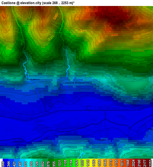
Below is the Elevation map of Castione, which displays elevation range with different colors. Scale of the first map is from 268 to 2253 m (879 to 7392 ft) with average elevation of 821.8 meters (=2696 ft) [note 1]
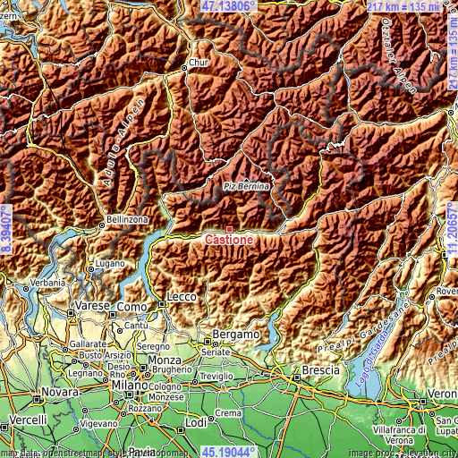
These maps also provides idea of topography and contour of this city, they are displayed at different zoom levels. More info about maps, scale and edge coordinates you can find below images.
| \ | Map #1 | Topo.Map |
| Scale [m] | 268..2253 m | × |
| Scale [ft] | 879..7392 ft | × |
| Average | 821.8 m = 2696 ft | × |
| Width | 6.77 km = 4.2 mi | 216.6 km = 134.6 mi |
| Height | 6.77 km = 4.2 mi | 216.5 km = 134.5 mi |
| ↑Max Latitude | 46.203293° | 47.13806° |
| Latitude at center | 46.17287° | 46.17287° |
| ↓Min Latitude | 46.14243° | 45.19044° |
| ← Min Longitude | 9.756375° | 8.39407° |
| Longitude center | 9.80032° | 9.80032° |
| →Max Longitude | 9.844265° | 11.20657° |
Nearby cities:
Cities around Castione sort by population:
• Sondrio elevation 304 m
5.5 km,  95°
95°
• Berbenno di Valtellina 344 m
4.1 km,  260°
260°
• Torchione-Moia 334 m
5 km,  113°
113°
• Castione Andevenno 447 m
0 km,  211°
211°
• Colorina 313 m
5.9 km,  248°
248°
• Caiolo 345 m
2.8 km,  156°
156°
• Fusine 293 m
4.7 km,  236°
236°
• Cedrasco 295 m
3.6 km,  223°
223°
• Torre di Santa Maria 779 m
7.8 km,  30°
30°
• Postalesio 500 m
1.8 km,  273°
273°
• Albosaggia 495 m
5 km,  124°
124°
• Spriana 745 m
7.2 km,  43°
43°
Multilingual:
 En español:
Castione elevación 447 m.
 En France:
Castione élévation 447 m.
 Auf Deutsch:
Castione höhe über dem Meeresspiegel ist 447 m.

Sources and notes:
- [note 1] Map square and city borders are not equal. Map elevation data is calculated only from area inside that square.
- [src 1] Elevation data from geonames database provided with same terms of usage.
- [src 2] The elevation map of Castione is generated using elevation data from NASA's 3 arcsec (90m) resolution SRTM data.
- [src 3] Base (background) map © OpenStreetMap contributors tiles are generated by Geofabrik and OpenTopoMap.
Copyright & License:
This Castione Elevation Map is licensed under CC BY-SA. You may reuse any part from this page, if you give a proper credit by linking to this URL:
 More info on terms of use page.