Borgo Lotti elevation
Borgo Lotti (Latium, Città metropolitana di Roma Capitale), Italy elevation is 109 meters and Borgo Lotti elevation in feet is 358 ft above sea level [src 1]. Borgo Lotti is a populated place (feature code) with elevation that is 213 meters (699 ft) smaller than average city elevation in Italy.
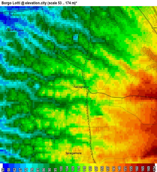
Below is the Elevation map of Borgo Lotti, which displays elevation range with different colors. Scale of the first map is from 53 to 174 m (174 to 571 ft) with average elevation of 108.7 meters (=357 ft) [note 1]
These maps also provides idea of topography and contour of this city, they are displayed at different zoom levels. More info about maps, scale and edge coordinates you can find below images.
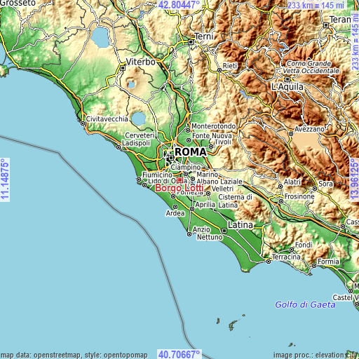
| \ | Map #1 | Topo.Map |
| Scale [m] | 53..174 m | × |
| Scale [ft] | 174..571 ft | × |
| Average | 108.7 m = 357 ft | × |
| Width | 7.29 km = 4.5 mi | 233.3 km = 145 mi |
| Height | 7.29 km = 4.5 mi | 233.2 km = 144.9 mi |
| ↑Max Latitude | 41.79691° | 42.80447° |
| Latitude at center | 41.76414° | 41.76414° |
| ↓Min Latitude | 41.731353° | 40.70667° |
| ← Min Longitude | 12.511055° | 11.14875° |
| Longitude center | 12.555° | 12.555° |
| →Max Longitude | 12.598945° | 13.96125° |
Nearby cities:
Cities around Borgo Lotti sort by population:
• Marino elevation 360 m
8.7 km,  85°
85°
• Ciampino 127 m
5.6 km,  43°
43°
• Albano Laziale 382 m
9.5 km,  115°
115°
• Grottaferrata 353 m
10 km,  75°
75°
• Ariccia 415 m
10.9 km, 116°
• Cecchina 266 m
10.5 km,  131°
131°
• Selcetta 66 m
6.6 km,  271°
271°
• Pavona 199 m
6.6 km, 129°
• Castel Gandolfo 384 m
8 km,  102°
102°
• Monte Migliore La Selvotta 95 m
6.5 km,  222°
222°
• Area Produttiva 104 m
10 km,  203°
203°
• Colle del Pino 83 m
5.4 km,  243°
243°
Multilingual:
 En español:
Borgo Lotti elevación 109 m.
 En France:
Borgo Lotti élévation 109 m.
 Auf Deutsch:
Borgo Lotti höhe über dem Meeresspiegel ist 109 m.

Sources and notes:
- [note 1] Map square and city borders are not equal. Map elevation data is calculated only from area inside that square.
- [src 1] Elevation data from geonames database provided with same terms of usage.
- [src 2] The elevation map of Borgo Lotti is generated using elevation data from NASA's 3 arcsec (90m) resolution SRTM data.
- [src 3] Base (background) map © OpenStreetMap contributors tiles are generated by Geofabrik and OpenTopoMap.
Copyright & License:
This Borgo Lotti Elevation Map is licensed under CC BY-SA. You may reuse any part from this page, if you give a proper credit by linking to this URL:
 More info on terms of use page.