Spartimento elevation
Spartimento (Campania, Napoli), Italy elevation is 59 meters and Spartimento elevation in feet is 194 ft above sea level [src 1]. Spartimento is a populated place (feature code) with elevation that is 263 meters (863 ft) smaller than average city elevation in Italy.
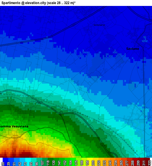
Below is the Elevation map of Spartimento, which displays elevation range with different colors. Scale of the first map is from 28 to 322 m (92 to 1056 ft) with average elevation of 78.4 meters (=257 ft) [note 1]
These maps also provides idea of topography and contour of this city, they are displayed at different zoom levels. More info about maps, scale and edge coordinates you can find below images.
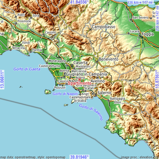
| \ | Map #1 | Topo.Map |
| Scale [m] | 28..322 m | × |
| Scale [ft] | 92..1056 ft | × |
| Average | 78.4 m = 257 ft | × |
| Width | 7.39 km = 4.6 mi | 236.4 km = 146.9 mi |
| Height | 7.39 km = 4.6 mi | 236.4 km = 146.9 mi |
| ↑Max Latitude | 40.924262° | 41.94556° |
| Latitude at center | 40.89105° | 40.89105° |
| ↓Min Latitude | 40.857821° | 39.81946° |
| ← Min Longitude | 14.428415° | 13.06611° |
| Longitude center | 14.47236° | 14.47236° |
| →Max Longitude | 14.516305° | 15.87861° |
Nearby cities:
Cities around Spartimento sort by population:
• Somma Vesuviana elevation 155 m
3.5 km,  235°
235°
• Marigliano 35 m
4 km,  340°
340°
• Ottaviano 184 m
4.4 km,  173°
173°
• Brusciano 32 m
5.4 km,  310°
310°
• Saviano 38 m
3.2 km,  60°
60°
• San Gennaro Vesuviano 55 m
5.4 km,  126°
126°
• Castello di Cisterna 40 m
5.8 km,  298°
298°
• Mariglianella 26 m
5.2 km,  325°
325°
• San Vitaliano 31 m
3.7 km,  2°
2°
• Piazzola 73 m
3.1 km, 131°
• Scisciano 35 m
1.7 km,  5°
5°
• Piazzolla 54 m
3.7 km,  92°
92°
Multilingual:
 En español:
Spartimento elevación 59 m.
 En France:
Spartimento élévation 59 m.
 Auf Deutsch:
Spartimento höhe über dem Meeresspiegel ist 59 m.

Sources and notes:
- [note 1] Map square and city borders are not equal. Map elevation data is calculated only from area inside that square.
- [src 1] Elevation data from geonames database provided with same terms of usage.
- [src 2] The elevation map of Spartimento is generated using elevation data from NASA's 3 arcsec (90m) resolution SRTM data.
- [src 3] Base (background) map © OpenStreetMap contributors tiles are generated by Geofabrik and OpenTopoMap.
Copyright & License:
This Spartimento Elevation Map is licensed under CC BY-SA. You may reuse any part from this page, if you give a proper credit by linking to this URL:
 More info on terms of use page.