Palazzolo elevation
Palazzolo (Sicily, Catania), Italy elevation is 322 meters and Palazzolo elevation in feet is 1056 ft above sea level [src 1]. Palazzolo is a populated place (feature code) with elevation that is 0 meters (0 ft) bigger than average city elevation in Italy.
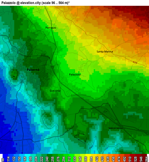
Below is the Elevation map of Palazzolo, which displays elevation range with different colors. Scale of the first map is from 96 to 564 m (315 to 1850 ft) with average elevation of 282.2 meters (=926 ft) [note 1]
These maps also provides idea of topography and contour of this city, they are displayed at different zoom levels. More info about maps, scale and edge coordinates you can find below images.
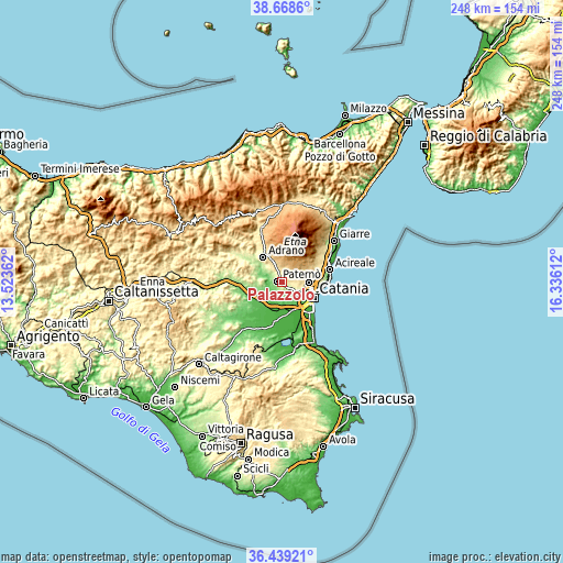
| \ | Map #1 | Topo.Map |
| Scale [m] | 96..564 m | × |
| Scale [ft] | 315..1850 ft | × |
| Average | 282.2 m = 926 ft | × |
| Width | 7.75 km = 4.8 mi | 247.9 km = 154 mi |
| Height | 7.75 km = 4.8 mi | 247.9 km = 154 mi |
| ↑Max Latitude | 37.597067° | 38.6686° |
| Latitude at center | 37.56224° | 37.56224° |
| ↓Min Latitude | 37.527397° | 36.43921° |
| ← Min Longitude | 14.885925° | 13.52362° |
| Longitude center | 14.92987° | 14.92987° |
| →Max Longitude | 14.973815° | 16.33612° |
Nearby cities:
Cities around Palazzolo sort by population:
• Paternò elevation 239 m
2.5 km,  281°
281°
• Misterbianco 223 m
8.5 km,  125°
125°
• Mascalucia 425 m
10.6 km,  82°
82°
• Biancavilla 519 m
10.7 km,  328°
328°
• Belpasso 559 m
5.5 km,  53°
53°
• Motta Sant'Anastasia 231 m
6.4 km,  150°
150°
• San Pietro Clarenza 447 m
8.2 km, 84°
• Santa Maria di Licodia 455 m
6.9 km, 332°
• Ragalna 778 m
8.2 km,  10°
10°
• Camporotondo Etneo 435 m
6.5 km,  86°
86°
• Villaggio del Pino-Le Ginestre 546 m
6.9 km,  70°
70°
• Belvedere-Piano Tavola 298 m
6.3 km, 125°
Multilingual:
 En español:
Palazzolo elevación 322 m.
 En France:
Palazzolo élévation 322 m.
 Auf Deutsch:
Palazzolo höhe über dem Meeresspiegel ist 322 m.

Sources and notes:
- [note 1] Map square and city borders are not equal. Map elevation data is calculated only from area inside that square.
- [src 1] Elevation data from geonames database provided with same terms of usage.
- [src 2] The elevation map of Palazzolo is generated using elevation data from NASA's 3 arcsec (90m) resolution SRTM data.
- [src 3] Base (background) map © OpenStreetMap contributors tiles are generated by Geofabrik and OpenTopoMap.
Copyright & License:
This Palazzolo Elevation Map is licensed under CC BY-SA. You may reuse any part from this page, if you give a proper credit by linking to this URL:
 More info on terms of use page.