Faella elevation
Faella (Tuscany, Province of Arezzo), Italy elevation is 149 meters and Faella elevation in feet is 489 ft above sea level [src 1]. Faella is a populated place (feature code) with elevation that is 173 meters (568 ft) smaller than average city elevation in Italy.
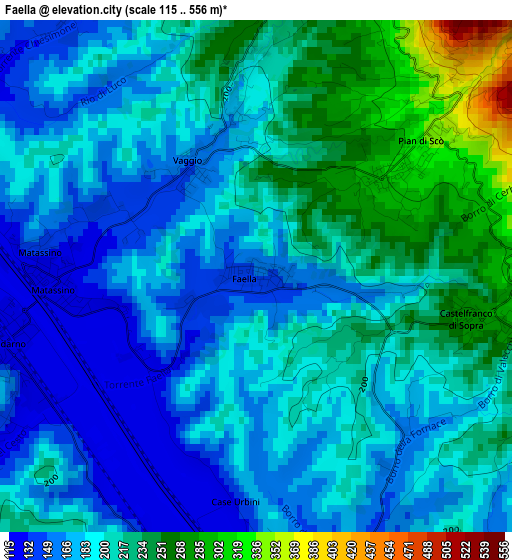
Below is the Elevation map of Faella, which displays elevation range with different colors. Scale of the first map is from 115 to 556 m (377 to 1824 ft) with average elevation of 197.9 meters (=649 ft) [note 1]
These maps also provides idea of topography and contour of this city, they are displayed at different zoom levels. More info about maps, scale and edge coordinates you can find below images.
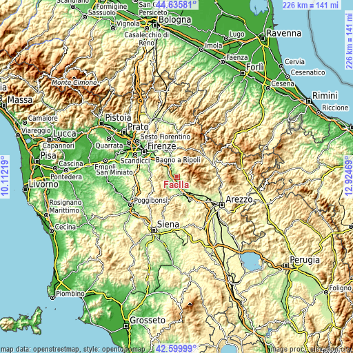
| \ | Map #1 | Topo.Map |
| Scale [m] | 115..556 m | × |
| Scale [ft] | 377..1824 ft | × |
| Average | 197.9 m = 649 ft | × |
| Width | 7.07 km = 4.4 mi | 226.4 km = 140.7 mi |
| Height | 7.07 km = 4.4 mi | 226.4 km = 140.7 mi |
| ↑Max Latitude | 43.658322° | 44.63581° |
| Latitude at center | 43.62652° | 43.62652° |
| ↓Min Latitude | 43.594702° | 42.59999° |
| ← Min Longitude | 11.474495° | 10.11219° |
| Longitude center | 11.51844° | 11.51844° |
| →Max Longitude | 11.562385° | 12.92469° |
Nearby cities:
Cities around Faella sort by population:
• San Giovanni Valdarno elevation 135 m
6.6 km,  172°
172°
• Figline Valdarno 125 m
3.8 km,  258°
258°
• Terranuova Bracciolini 155 m
9.8 km,  149°
149°
• Incisa in Val d'Arno 123 m
6.4 km,  299°
299°
• Reggello 365 m
6 km,  8°
8°
• Rignano sull'Arno 135 m
11.8 km,  333°
333°
• Loro Ciuffenna 310 m
9.9 km,  115°
115°
• Pian di Scò 327 m
2.8 km,  51°
51°
• Castelfranco di Sopra 286 m
3.3 km,  99°
99°
• San Cipriano-S.Barbara-Centinale 142 m
7 km,  202°
202°
• Castelnuovo dei Sabbioni 290 m
10.9 km,  209°
209°
• Vacchereccia 145 m
7.4 km,  190°
190°
Multilingual:
 En español:
Faella elevación 149 m.
 En France:
Faella élévation 149 m.


Sources and notes:
- [note 1] Map square and city borders are not equal. Map elevation data is calculated only from area inside that square.
- [src 1] Elevation data from geonames database provided with same terms of usage.
- [src 2] The elevation map of Faella is generated using elevation data from NASA's 3 arcsec (90m) resolution SRTM data.
- [src 3] Base (background) map © OpenStreetMap contributors tiles are generated by Geofabrik and OpenTopoMap.
Copyright & License:
This Faella Elevation Map is licensed under CC BY-SA. You may reuse any part from this page, if you give a proper credit by linking to this URL:
 More info on terms of use page.