Caldine elevation
Caldine (Tuscany, Province of Florence), Italy elevation is 146 meters and Caldine elevation in feet is 479 ft above sea level [src 1]. Caldine is a populated place (feature code) with elevation that is 176 meters (577 ft) smaller than average city elevation in Italy.
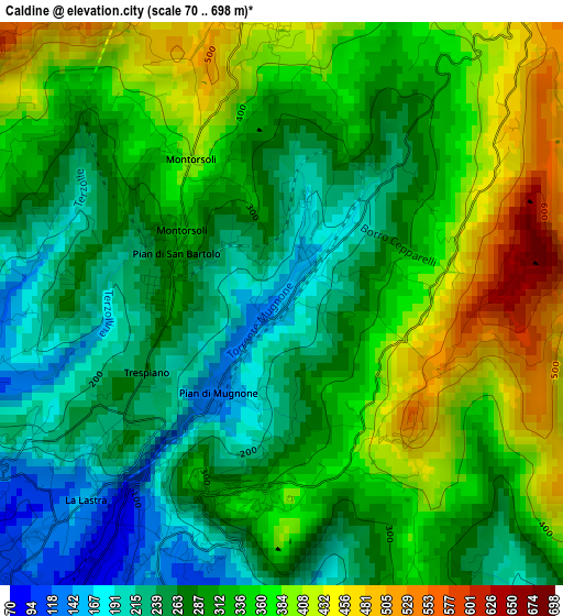
Below is the Elevation map of Caldine, which displays elevation range with different colors. Scale of the first map is from 70 to 698 m (230 to 2290 ft) with average elevation of 314.8 meters (=1033 ft) [note 1]
These maps also provides idea of topography and contour of this city, they are displayed at different zoom levels. More info about maps, scale and edge coordinates you can find below images.
| \ | Map #1 | Topo.Map |
| Scale [m] | 70..698 m | × |
| Scale [ft] | 230..2290 ft | × |
| Average | 314.8 m = 1033 ft | × |
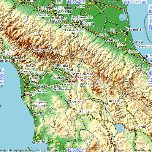
| Width | 7.05 km = 4.4 mi | 225.6 km = 140.2 mi |
| Height | 7.05 km = 4.4 mi | 225.6 km = 140.2 mi |
| ↑Max Latitude | 43.860035° | 44.83421° |
| Latitude at center | 43.82834° | 43.82834° |
| ↓Min Latitude | 43.796629° | 42.80523° |
| ← Min Longitude | 11.260475° | 9.89817° |
| Longitude center | 11.30442° | 11.30442° |
| →Max Longitude | 11.348365° | 12.71067° |
Nearby cities:
Cities around Caldine sort by population:
• Florence elevation 51 m
7.2 km,  220°
220°
• Sesto Fiorentino 60 m
8.4 km,  272°
272°
• Grassina Ponte a Ema 87 m
10.6 km,  181°
181°
• Bagno a Ripoli 92 m
8.7 km,  170°
170°
• Sieci 76 m
8.5 km,  121°
121°
• Antella 121 m
11.3 km, 172°
• Fiesole 312 m
2.8 km,  196°
196°
• Compiobbi 75 m
6.5 km,  137°
137°
• San Jacopo al Girone 66 m
7.1 km,  156°
156°
• Molino del Piano 104 m
7.9 km,  104°
104°
• Pian di Mugnone 138 m
1.3 km,  211°
211°
• Vaglia 281 m
9.4 km,  347°
347°
Multilingual:
 En español:
Caldine elevación 146 m.
 En France:
Caldine élévation 146 m.


Sources and notes:
- [note 1] Map square and city borders are not equal. Map elevation data is calculated only from area inside that square.
- [src 1] Elevation data from geonames database provided with same terms of usage.
- [src 2] The elevation map of Caldine is generated using elevation data from NASA's 3 arcsec (90m) resolution SRTM data.
- [src 3] Base (background) map © OpenStreetMap contributors tiles are generated by Geofabrik and OpenTopoMap.
Copyright & License:
This Caldine Elevation Map is licensed under CC BY-SA. You may reuse any part from this page, if you give a proper credit by linking to this URL:
 More info on terms of use page.