Ponticella elevation
Ponticella (Emilia-Romagna, Bologna), Italy elevation is 132 meters and Ponticella elevation in feet is 433 ft above sea level [src 1]. Ponticella is a populated place (feature code) with elevation that is 190 meters (623 ft) smaller than average city elevation in Italy.
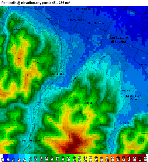
Below is the Elevation map of Ponticella, which displays elevation range with different colors. Scale of the first map is from 45 to 386 m (148 to 1266 ft) with average elevation of 138.3 meters (=454 ft) [note 1]
These maps also provides idea of topography and contour of this city, they are displayed at different zoom levels. More info about maps, scale and edge coordinates you can find below images.
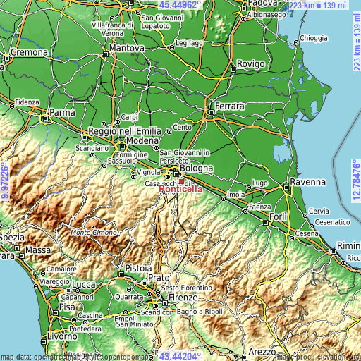
| \ | Map #1 | Topo.Map |
| Scale [m] | 45..386 m | × |
| Scale [ft] | 148..1266 ft | × |
| Average | 138.3 m = 454 ft | × |
| Width | 6.98 km = 4.3 mi | 223.2 km = 138.7 mi |
| Height | 6.98 km = 4.3 mi | 223.2 km = 138.7 mi |
| ↑Max Latitude | 44.48582° | 45.44962° |
| Latitude at center | 44.45446° | 44.45446° |
| ↓Min Latitude | 44.423083° | 43.44204° |
| ← Min Longitude | 11.334565° | 9.97226° |
| Longitude center | 11.37851° | 11.37851° |
| →Max Longitude | 11.422455° | 12.78476° |
Nearby cities:
Cities around Ponticella sort by population:
• Bologna elevation 71 m
5.4 km,  324°
324°
• Casalecchio di Reno 71 m
8.5 km,  285°
285°
• San Lazzaro 66 m
3 km,  53°
53°
• Castenaso 34 m
9.7 km, 47°
• Ozzano dell'Emilia 61 m
7.8 km,  98°
98°
• Pianoro 186 m
7.8 km,  201°
201°
• Rastignano-Carteria di Sesto 117 m
2.7 km,  220°
220°
• Borgonuovo 101 m
8.8 km,  256°
256°
• Villanova 44 m
6.6 km,  39°
39°
• Pizzano 178 m
11.4 km,  165°
165°
• Quarto Inferiore 36 m
9 km,  19°
19°
• Pulce 88 m
2.7 km, 102°
Multilingual:
 En español:
Ponticella elevación 132 m.
 En France:
Ponticella élévation 132 m.
 Auf Deutsch:
Ponticella höhe über dem Meeresspiegel ist 132 m.

Sources and notes:
- [note 1] Map square and city borders are not equal. Map elevation data is calculated only from area inside that square.
- [src 1] Elevation data from geonames database provided with same terms of usage.
- [src 2] The elevation map of Ponticella is generated using elevation data from NASA's 3 arcsec (90m) resolution SRTM data.
- [src 3] Base (background) map © OpenStreetMap contributors tiles are generated by Geofabrik and OpenTopoMap.
Copyright & License:
This Ponticella Elevation Map is licensed under CC BY-SA. You may reuse any part from this page, if you give a proper credit by linking to this URL:
 More info on terms of use page.