Prato Perillo elevation
Prato Perillo (Campania, Provincia di Salerno), Italy elevation is 458 meters and Prato Perillo elevation in feet is 1503 ft above sea level [src 1]. Prato Perillo is a populated place (feature code) with elevation that is 136 meters (446 ft) bigger than average city elevation in Italy.
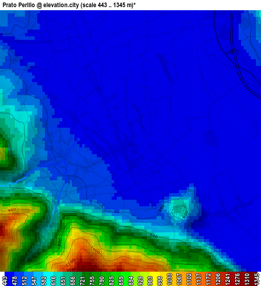
Below is the Elevation map of Prato Perillo, which displays elevation range with different colors. Scale of the first map is from 443 to 1345 m (1453 to 4413 ft) with average elevation of 546.5 meters (=1793 ft) [note 1]
These maps also provides idea of topography and contour of this city, they are displayed at different zoom levels. More info about maps, scale and edge coordinates you can find below images.
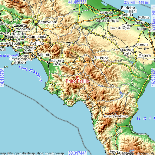
| \ | Map #1 | Topo.Map |
| Scale [m] | 443..1345 m | × |
| Scale [ft] | 1453..4413 ft | × |
| Average | 546.5 m = 1793 ft | × |
| Width | 7.44 km = 4.6 mi | 238.2 km = 148 mi |
| Height | 7.44 km = 4.6 mi | 238.1 km = 147.9 mi |
| ↑Max Latitude | 40.430359° | 41.45933° |
| Latitude at center | 40.3969° | 40.3969° |
| ↓Min Latitude | 40.363424° | 39.31744° |
| ← Min Longitude | 15.481085° | 14.11878° |
| Longitude center | 15.52503° | 15.52503° |
| →Max Longitude | 15.568975° | 16.93128° |
Nearby cities:
Cities around Prato Perillo sort by population:
• Sala Consilina elevation 542 m
5.6 km,  84°
84°
• Brienza 695 m
12.6 km,  44°
44°
• Sant'Arsenio 448 m
8.9 km,  337°
337°
• Padula 604 m
12.9 km,  120°
120°
• Teggiano-Macchiaroli 638 m
2.4 km,  146°
146°
• Sassano 477 m
7.2 km, 151°
• Monte San Giacomo 652 m
6 km,  166°
166°
• San Pietro al Tanagro 455 m
7.2 km,  333°
333°
• Atena Lucana 630 m
6.9 km,  22°
22°
• San Rufo 652 m
6.7 km,  308°
308°
• Corleto Monforte 629 m
13.1 km,  290°
290°
• Sacco 559 m
12.7 km,  259°
259°
Multilingual:
 En español:
Prato Perillo elevación 458 m.
 En France:
Prato Perillo élévation 458 m.
 Auf Deutsch:
Prato Perillo höhe über dem Meeresspiegel ist 458 m.

Sources and notes:
- [note 1] Map square and city borders are not equal. Map elevation data is calculated only from area inside that square.
- [src 1] Elevation data from geonames database provided with same terms of usage.
- [src 2] The elevation map of Prato Perillo is generated using elevation data from NASA's 3 arcsec (90m) resolution SRTM data.
- [src 3] Base (background) map © OpenStreetMap contributors tiles are generated by Geofabrik and OpenTopoMap.
Copyright & License:
This Prato Perillo Elevation Map is licensed under CC BY-SA. You may reuse any part from this page, if you give a proper credit by linking to this URL:
 More info on terms of use page.