Sant'Antonio elevation
Sant'Antonio (Campania, Provincia di Salerno), Italy elevation is 33 meters and Sant'Antonio elevation in feet is 108 ft above sea level [src 1]. Sant'Antonio is a populated place (feature code) with elevation that is 289 meters (948 ft) smaller than average city elevation in Italy.
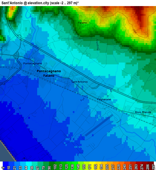
Below is the Elevation map of Sant'Antonio, which displays elevation range with different colors. Scale of the first map is from -2 to 297 m (-7 to 974 ft) with average elevation of 54.9 meters (=180 ft) [note 1]
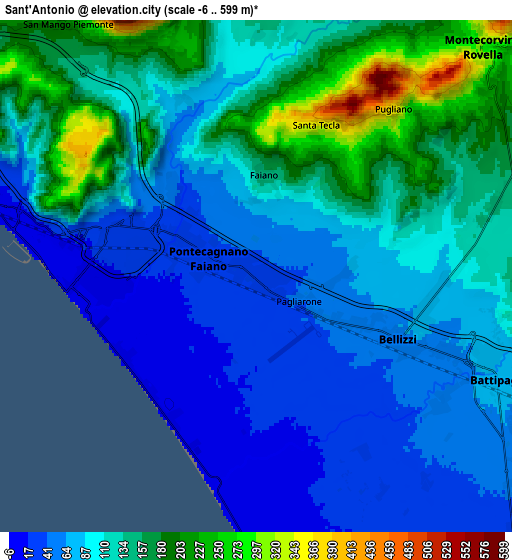
These maps also provides idea of topography and contour of this city, they are displayed at different zoom levels. More info about maps, scale and edge coordinates you can find below images.
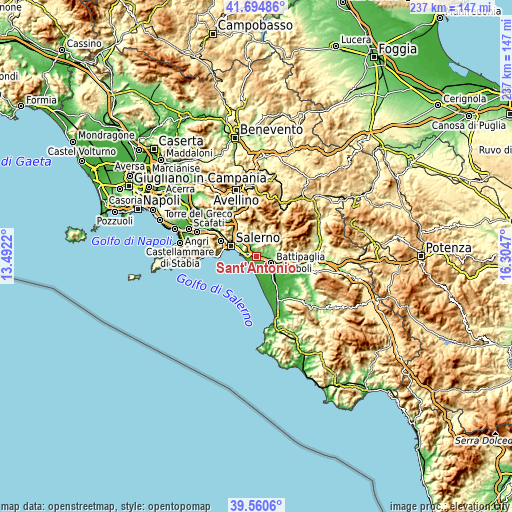
| \ | Map #1 | Map #2 | Topo.Map |
| Scale [m] | -2..297 m | -6..599 m | × |
| Scale [ft] | -7..974 ft | -20..1965 ft | × |
| Average | 54.9 m = 180 ft | 109.2 m = 358 ft | × |
| Width | 7.42 km = 4.6 mi | 14.83 km = 9.2 mi | 237.3 km = 147.5 mi |
| Height | 7.42 km = 4.6 mi | 14.83 km = 9.2 mi | 237.3 km = 147.5 mi |
| ↑Max Latitude | 40.6696° | 40.702923° | 41.69486° |
| Latitude at center | 40.63626° | 40.63626° | 40.63626° |
| ↓Min Latitude | 40.602903° | 40.56953° | 39.5606° |
| ← Min Longitude | 14.854505° | 14.810559° | 13.4922° |
| Longitude center | 14.89845° | 14.89845° | 14.89845° |
| →Max Longitude | 14.942395° | 14.986341° | 16.3047° |
Nearby cities:
Cities around Sant'Antonio sort by population:
• Battipaglia elevation 78 m
7.7 km,  113°
113°
• Pontecagnano 34 m
2.1 km,  296°
296°
• Bellizzi 62 m
4.5 km, 114°
• Montecorvino Pugliano 363 m
6.2 km,  39°
39°
• Faiano 148 m
2.9 km,  6°
6°
• Pratole 50 m
2.6 km,  116°
116°
• Pezzano-Filetta 239 m
7.3 km,  340°
340°
• Macchia 138 m
7 km,  74°
74°
• Pagliarone 45 m
1.4 km, 118°
• Santa Tecla-Castelpagano 306 m
4.5 km,  21°
21°
• Fuorni 23 m
4.2 km,  276°
276°
• Pugliano 357 m
6.2 km, 39°
Multilingual:
 En español:
Sant'Antonio elevación 33 m.
 En France:
Sant'Antonio élévation 33 m.
 Auf Deutsch:
Sant'Antonio höhe über dem Meeresspiegel ist 33 m.

Sources and notes:
- [note 1] Map square and city borders are not equal. Map elevation data is calculated only from area inside that square.
- [src 1] Elevation data from geonames database provided with same terms of usage.
- [src 2] The elevation map of Sant'Antonio is generated using elevation data from NASA's 3 arcsec (90m) resolution SRTM data.
- [src 3] Base (background) map © OpenStreetMap contributors tiles are generated by Geofabrik and OpenTopoMap.
Copyright & License:
This Sant'Antonio Elevation Map is licensed under CC BY-SA. You may reuse any part from this page, if you give a proper credit by linking to this URL:
 More info on terms of use page.