Santa Margherita elevation
Santa Margherita (Lombardy, Provincia di Monza e della Brianza), Italy elevation is 208 meters and Santa Margherita elevation in feet is 682 ft above sea level [src 1]. Santa Margherita is a populated place (feature code) with elevation that is 114 meters (374 ft) smaller than average city elevation in Italy.
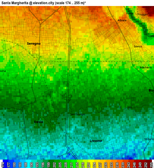
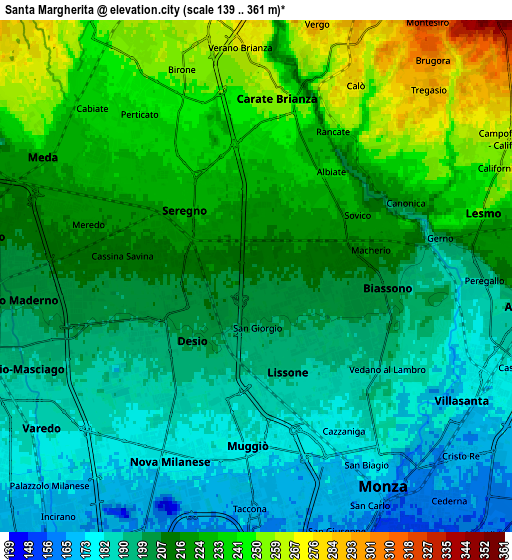
Below is the Elevation map of Santa Margherita, which displays elevation range with different colors. Scale of the first map is from 174 to 255 m (571 to 837 ft) with average elevation of 209.3 meters (=687 ft) [note 1]
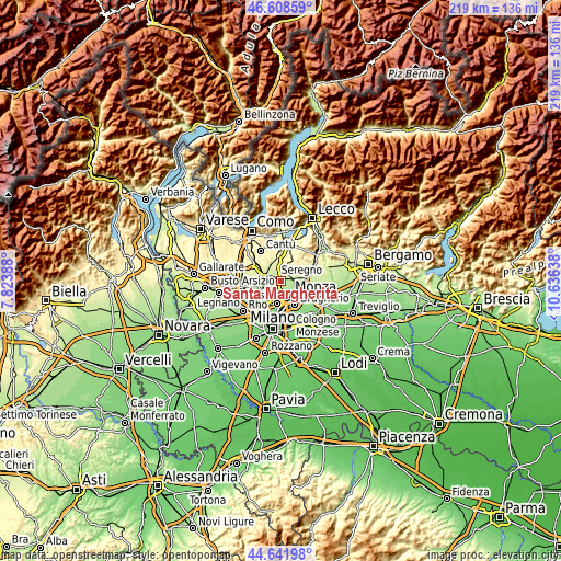
These maps also provides idea of topography and contour of this city, they are displayed at different zoom levels. More info about maps, scale and edge coordinates you can find below images.
| \ | Map #1 | Map #2 | Topo.Map |
| Scale [m] | 174..255 m | 139..361 m | × |
| Scale [ft] | 571..837 ft | 456..1184 ft | × |
| Average | 209.3 m = 687 ft | 211.9 m = 695 ft | × |
| Width | 6.83 km = 4.2 mi | 13.67 km = 8.5 mi | 218.7 km = 135.9 mi |
| Height | 6.83 km = 4.2 mi | 13.67 km = 8.5 mi | 218.7 km = 135.9 mi |
| ↑Max Latitude | 45.66463° | 45.695333° | 46.60859° |
| Latitude at center | 45.63391° | 45.63391° | 45.63391° |
| ↓Min Latitude | 45.603173° | 45.57242° | 44.64198° |
| ← Min Longitude | 9.186185° | 9.142239° | 7.82388° |
| Longitude center | 9.23013° | 9.23013° | 9.23013° |
| →Max Longitude | 9.274075° | 9.318021° | 10.63638° |
Nearby cities:
Cities around Santa Margherita sort by population:
• Seregno elevation 229 m
2.6 km,  313°
313°
• Desio 198 m
2.8 km,  231°
231°
• Lissone 192 m
2.5 km,  162°
162°
• Muggiò 174 m
5 km,  182°
182°
• Carate Brianza 257 m
4.7 km,  6°
6°
• Biassono 203 m
3.2 km,  100°
100°
• Sovico 221 m
2.9 km,  62°
62°
• Vedano al Lambro 186 m
4.1 km,  133°
133°
• Macherio 214 m
3.5 km,  79°
79°
• Albiate 230 m
2.9 km,  33°
33°
• Triuggio 237 m
4.2 km,  43°
43°
• Canonica 244 m
5.1 km, 61°
Multilingual:
 En español:
Santa Margherita elevación 208 m.
 En France:
Santa Margherita élévation 208 m.
 Auf Deutsch:
Santa Margherita höhe über dem Meeresspiegel ist 208 m.

Sources and notes:
- [note 1] Map square and city borders are not equal. Map elevation data is calculated only from area inside that square.
- [src 1] Elevation data from geonames database provided with same terms of usage.
- [src 2] The elevation map of Santa Margherita is generated using elevation data from NASA's 3 arcsec (90m) resolution SRTM data.
- [src 3] Base (background) map © OpenStreetMap contributors tiles are generated by Geofabrik and OpenTopoMap.
Copyright & License:
This Santa Margherita Elevation Map is licensed under CC BY-SA. You may reuse any part from this page, if you give a proper credit by linking to this URL:
 More info on terms of use page.