Vedano al Lambro elevation
Vedano al Lambro (Lombardy, Provincia di Monza e della Brianza), Italy elevation is 186 meters and Vedano al Lambro elevation in feet is 610 ft above sea level [src 1]. Vedano al Lambro is a seat of a third-order administrative division (feature code) with elevation that is 136 meters (446 ft) smaller than average city elevation in Italy.
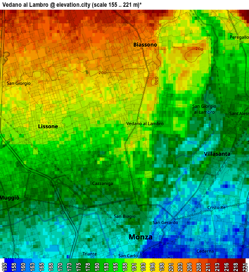
Below is the Elevation map of Vedano al Lambro, which displays elevation range with different colors. Scale of the first map is from 155 to 221 m (509 to 725 ft) with average elevation of 184.1 meters (=604 ft) [note 1]
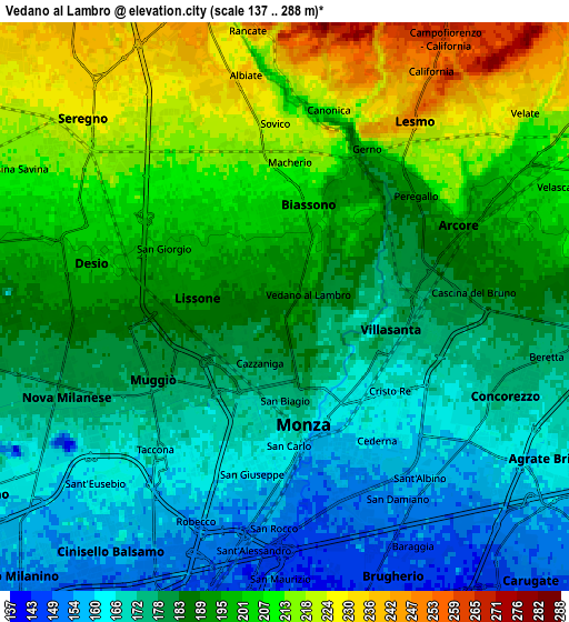
These maps also provides idea of topography and contour of this city, they are displayed at different zoom levels. More info about maps, scale and edge coordinates you can find below images.
| \ | Map #1 | Map #2 | Topo.Map |
| Scale [m] | 155..221 m | 137..288 m | × |
| Scale [ft] | 509..725 ft | 449..945 ft | × |
| Average | 184.1 m = 604 ft | 188.8 m = 619 ft | × |
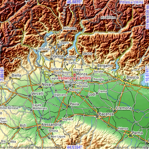
| Width | 6.84 km = 4.3 mi | 13.67 km = 8.5 mi | 218.8 km = 136 mi |
| Height | 6.84 km = 4.3 mi | 13.67 km = 8.5 mi | 218.8 km = 136 mi |
| ↑Max Latitude | 45.639514° | 45.670231° | 46.5839° |
| Latitude at center | 45.60878° | 45.60878° | 45.60878° |
| ↓Min Latitude | 45.578029° | 45.547262° | 44.6164° |
| ← Min Longitude | 9.223905° | 9.179959° | 7.8616° |
| Longitude center | 9.26785° | 9.26785° | 9.26785° |
| →Max Longitude | 9.311795° | 9.355741° | 10.6741° |
Nearby cities:
Cities around Vedano al Lambro sort by population:
• Monza elevation 171 m
3.2 km,  173°
173°
• Desio 198 m
5.2 km,  281°
281°
• Lissone 192 m
2.2 km, 280°
• Muggiò 174 m
3.8 km,  234°
234°
• Arcore 195 m
4.8 km,  65°
65°
• Villasanta 174 m
3.1 km,  94°
94°
• Biassono 203 m
2.2 km,  6°
6°
• Lesmo 247 m
5.4 km,  34°
34°
• Sovico 221 m
4.2 km,  354°
354°
• Macherio 214 m
3.5 km, 7°
• Albiate 230 m
5.4 km, 345°
• Santa Margherita 208 m
4.1 km,  313°
313°
Multilingual:
 En español:
Vedano al Lambro elevación 186 m.
 En France:
Vedano al Lambro élévation 186 m.
 Auf Deutsch:
Vedano al Lambro höhe über dem Meeresspiegel ist 186 m.

Sources and notes:
- [note 1] Map square and city borders are not equal. Map elevation data is calculated only from area inside that square.
- [src 1] Elevation data from geonames database provided with same terms of usage.
- [src 2] The elevation map of Vedano al Lambro is generated using elevation data from NASA's 3 arcsec (90m) resolution SRTM data.
- [src 3] Base (background) map © OpenStreetMap contributors tiles are generated by Geofabrik and OpenTopoMap.
Copyright & License:
This Vedano al Lambro Elevation Map is licensed under CC BY-SA. You may reuse any part from this page, if you give a proper credit by linking to this URL:
 More info on terms of use page.