Quadrivio elevation
Quadrivio (Campania, Provincia di Salerno), Italy elevation is 138 meters and Quadrivio elevation in feet is 453 ft above sea level [src 1]. Quadrivio is a populated place (feature code) with elevation that is 184 meters (604 ft) smaller than average city elevation in Italy.
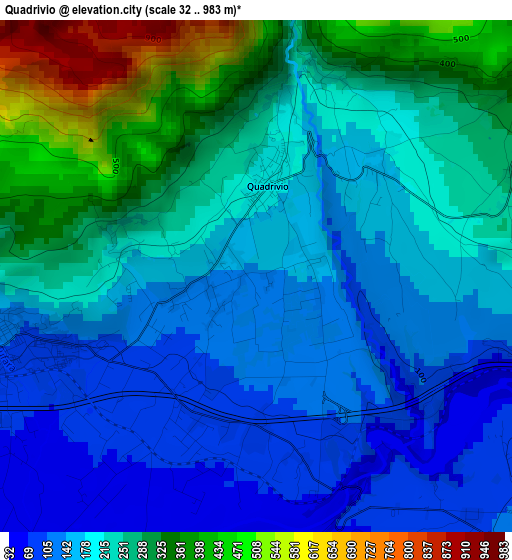
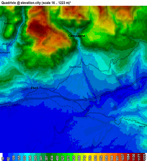
Below is the Elevation map of Quadrivio, which displays elevation range with different colors. Scale of the first map is from 32 to 983 m (105 to 3225 ft) with average elevation of 222.7 meters (=731 ft) [note 1]
These maps also provides idea of topography and contour of this city, they are displayed at different zoom levels. More info about maps, scale and edge coordinates you can find below images.
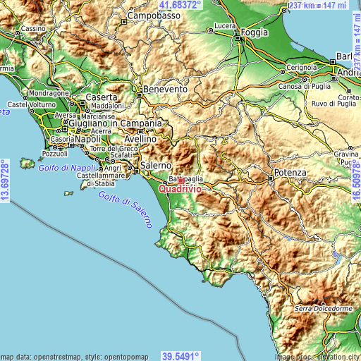
| \ | Map #1 | Map #2 | Topo.Map |
| Scale [m] | 32..983 m | 16..1223 m | × |
| Scale [ft] | 105..3225 ft | 52..4012 ft | × |
| Average | 222.7 m = 731 ft | 291.4 m = 956 ft | × |
| Width | 7.42 km = 4.6 mi | 14.83 km = 9.2 mi | 237.3 km = 147.5 mi |
| Height | 7.42 km = 4.6 mi | 14.83 km = 9.2 mi | 237.3 km = 147.5 mi |
| ↑Max Latitude | 40.658286° | 40.691615° | 41.68372° |
| Latitude at center | 40.62494° | 40.62494° | 40.62494° |
| ↓Min Latitude | 40.591578° | 40.558199° | 39.5491° |
| ← Min Longitude | 15.059585° | 15.015639° | 13.69728° |
| Longitude center | 15.10353° | 15.10353° | 15.10353° |
| →Max Longitude | 15.147475° | 15.191421° | 16.50978° |
Nearby cities:
Cities around Quadrivio sort by population:
• Battipaglia elevation 78 m
10.4 km,  259°
259°
• Eboli 116 m
4 km, 258°
• Montecorvino Rovella 310 m
12.9 km,  305°
305°
• Olevano sul Tusciano 191 m
7.7 km,  297°
297°
• Monticelli 143 m
7.8 km,  290°
290°
• Campagna 287 m
4.6 km,  2°
2°
• Serre 223 m
8.4 km,  124°
124°
• Macchia 138 m
11 km, 286°
• Contursi Terme 279 m
12 km,  76°
76°
• Ariano 170 m
7.5 km, 297°
• Salitto-Valle 372 m
8.8 km, 308°
• Altavilla Silentina 316 m
10.8 km,  167°
167°
Multilingual:
 En español:
Quadrivio elevación 138 m.
 En France:
Quadrivio élévation 138 m.
 Auf Deutsch:
Quadrivio höhe über dem Meeresspiegel ist 138 m.

Sources and notes:
- [note 1] Map square and city borders are not equal. Map elevation data is calculated only from area inside that square.
- [src 1] Elevation data from geonames database provided with same terms of usage.
- [src 2] The elevation map of Quadrivio is generated using elevation data from NASA's 3 arcsec (90m) resolution SRTM data.
- [src 3] Base (background) map © OpenStreetMap contributors tiles are generated by Geofabrik and OpenTopoMap.
Copyright & License:
This Quadrivio Elevation Map is licensed under CC BY-SA. You may reuse any part from this page, if you give a proper credit by linking to this URL:
 More info on terms of use page.