Orentano elevation
Orentano (Tuscany, Province of Pisa), Italy elevation is 29 meters and Orentano elevation in feet is 95 ft above sea level [src 1]. Orentano is a populated locality (feature code) with elevation that is 293 meters (961 ft) smaller than average city elevation in Italy.
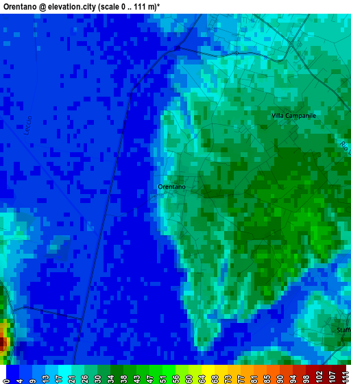
Below is the Elevation map of Orentano, which displays elevation range with different colors. Scale of the first map is from 0 to 111 m (0 to 364 ft) with average elevation of 16 meters (=52 ft) [note 1]
These maps also provides idea of topography and contour of this city, they are displayed at different zoom levels. More info about maps, scale and edge coordinates you can find below images.
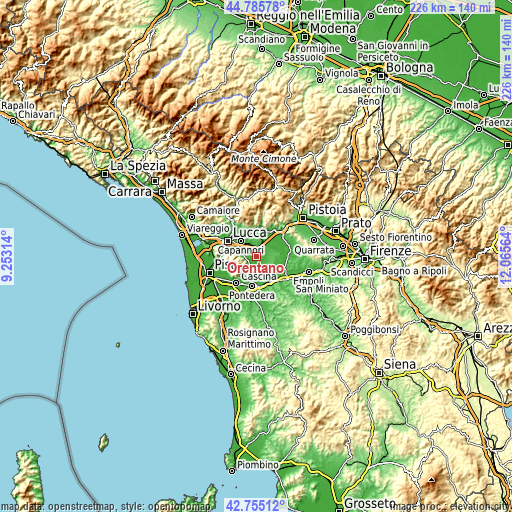
| \ | Map #1 | Topo.Map |
| Scale [m] | 0..111 m | × |
| Scale [ft] | 0..364 ft | × |
| Average | 16 m = 52 ft | × |
| Width | 7.06 km = 4.4 mi | 225.8 km = 140.3 mi |
| Height | 7.06 km = 4.4 mi | 225.8 km = 140.3 mi |
| ↑Max Latitude | 43.810791° | 44.78578° |
| Latitude at center | 43.77907° | 43.77907° |
| ↓Min Latitude | 43.747332° | 42.75512° |
| ← Min Longitude | 10.615445° | 9.25314° |
| Longitude center | 10.65939° | 10.65939° |
| →Max Longitude | 10.703335° | 12.06564° |
Nearby cities:
Cities around Orentano sort by population:
• Capannori elevation 15 m
9.8 km,  315°
315°
• Altopascio 15 m
4.4 km,  18°
18°
• Porcari 17 m
7.8 km,  333°
333°
• Santa Maria a Monte 86 m
8.3 km,  161°
161°
• Bientina 14 m
8.5 km,  201°
201°
• Cascine-La Croce 36 m
6.6 km,  212°
212°
• Chiesina Uzzanese 22 m
8.3 km,  36°
36°
• Buti 103 m
8.2 km,  226°
226°
• Quattro Strade 57 m
7.8 km,  180°
180°
• Anchione 18 m
9.5 km,  56°
56°
• Spianate 27 m
5.7 km,  51°
51°
• Montecarlo 152 m
8.2 km,  4°
4°
Multilingual:
 En español:
Orentano elevación 29 m.
 En France:
Orentano élévation 29 m.


Sources and notes:
- [note 1] Map square and city borders are not equal. Map elevation data is calculated only from area inside that square.
- [src 1] Elevation data from geonames database provided with same terms of usage.
- [src 2] The elevation map of Orentano is generated using elevation data from NASA's 3 arcsec (90m) resolution SRTM data.
- [src 3] Base (background) map © OpenStreetMap contributors tiles are generated by Geofabrik and OpenTopoMap.
Copyright & License:
This Orentano Elevation Map is licensed under CC BY-SA. You may reuse any part from this page, if you give a proper credit by linking to this URL:
 More info on terms of use page.