Noviglio elevation
Noviglio (Lombardy, Città metropolitana di Milano), Italy elevation is 104 meters and Noviglio elevation in feet is 341 ft above sea level [src 1]. Noviglio is a populated place (feature code) with elevation that is 218 meters (715 ft) smaller than average city elevation in Italy.
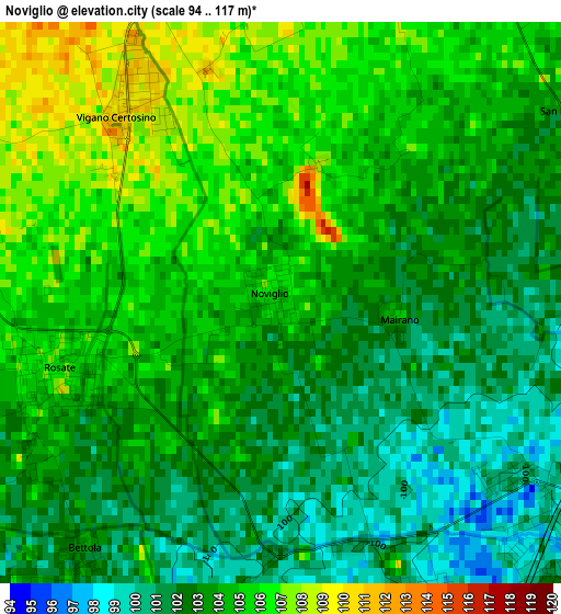
Below is the Elevation map of Noviglio, which displays elevation range with different colors. Scale of the first map is from 94 to 117 m (308 to 384 ft) with average elevation of 103.4 meters (=339 ft) [note 1]
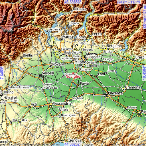
These maps also provides idea of topography and contour of this city, they are displayed at different zoom levels. More info about maps, scale and edge coordinates you can find below images.
| \ | Map #1 | Topo.Map |
| Scale [m] | 94..117 m | × |
| Scale [ft] | 308..384 ft | × |
| Average | 103.4 m = 339 ft | × |
| Width | 6.87 km = 4.3 mi | 219.7 km = 136.5 mi |
| Height | 6.87 km = 4.3 mi | 219.7 km = 136.5 mi |
| ↑Max Latitude | 45.38994° | 46.33856° |
| Latitude at center | 45.35907° | 45.35907° |
| ↓Min Latitude | 45.328183° | 44.36232° |
| ← Min Longitude | 9.008205° | 7.6459° |
| Longitude center | 9.05215° | 9.05215° |
| →Max Longitude | 9.096095° | 10.4584° |
Nearby cities:
Cities around Noviglio sort by population:
• Binasco elevation 99 m
4.5 km,  133°
133°
• Gaggiano 115 m
5.3 km,  345°
345°
• Rosate 107 m
3 km,  249°
249°
• Zibido San Giacomo 100 m
4.6 km,  88°
88°
• Bubbiano 105 m
4.6 km,  219°
219°
• Gudo Visconti 111 m
4.4 km,  292°
292°
• Moncucco 101 m
5.5 km,  190°
190°
• Santa Corinna 99 m
3.6 km, 126°
• Bettola 103 m
3.9 km, 218°
• Mairano 104 m
1.4 km,  95°
95°
• Vernate 101 m
4.8 km,  172°
172°
• Calvignasco 102 m
4.1 km,  207°
207°
Multilingual:
 En español:
Noviglio elevación 104 m.
 En France:
Noviglio élévation 104 m.
 Auf Deutsch:
Noviglio höhe über dem Meeresspiegel ist 104 m.

Sources and notes:
- [note 1] Map square and city borders are not equal. Map elevation data is calculated only from area inside that square.
- [src 1] Elevation data from geonames database provided with same terms of usage.
- [src 2] The elevation map of Noviglio is generated using elevation data from NASA's 3 arcsec (90m) resolution SRTM data.
- [src 3] Base (background) map © OpenStreetMap contributors tiles are generated by Geofabrik and OpenTopoMap.
Copyright & License:
This Noviglio Elevation Map is licensed under CC BY-SA. You may reuse any part from this page, if you give a proper credit by linking to this URL:
 More info on terms of use page.