Viverone elevation
Viverone (Piedmont, Provincia di Biella), Italy elevation is 282 meters and Viverone elevation in feet is 925 ft above sea level [src 1]. Viverone is a seat of a third-order administrative division (feature code) with elevation that is 40 meters (131 ft) smaller than average city elevation in Italy.
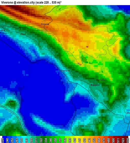
Below is the Elevation map of Viverone, which displays elevation range with different colors. Scale of the first map is from 228 to 535 m (748 to 1755 ft) with average elevation of 316.6 meters (=1039 ft) [note 1]
These maps also provides idea of topography and contour of this city, they are displayed at different zoom levels. More info about maps, scale and edge coordinates you can find below images.
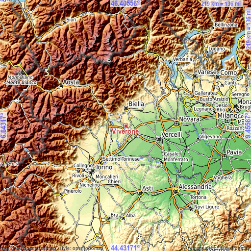
| \ | Map #1 | Topo.Map |
| Scale [m] | 228..535 m | × |
| Scale [ft] | 748..1755 ft | × |
| Average | 316.6 m = 1039 ft | × |
| Width | 6.86 km = 4.3 mi | 219.5 km = 136.4 mi |
| Height | 6.86 km = 4.3 mi | 219.5 km = 136.4 mi |
| ↑Max Latitude | 45.458093° | 46.40556° |
| Latitude at center | 45.42726° | 45.42726° |
| ↓Min Latitude | 45.39641° | 44.43171° |
| ← Min Longitude | 8.005475° | 6.64317° |
| Longitude center | 8.04942° | 8.04942° |
| →Max Longitude | 8.093365° | 9.45567° |
Nearby cities:
Cities around Viverone sort by population:
• Cavaglià elevation 279 m
4.1 km,  125°
125°
• Azeglio 239 m
4.5 km,  263°
263°
• Piverone 284 m
3.9 km,  301°
301°
• Palazzo Canavese 246 m
6.6 km, 302°
• Salussola 260 m
5.3 km,  65°
65°
• Roppolo 312 m
1.8 km,  115°
115°
• Settimo Rottaro 260 m
4.9 km,  243°
243°
• Zimone 445 m
2.6 km,  338°
338°
• Dorzano 300 m
3.8 km,  91°
91°
• Cerrione 260 m
4.9 km,  17°
17°
• Cossano Canavese 349 m
6.3 km,  225°
225°
• Magnano 538 m
5.4 km,  317°
317°
Multilingual:
 En español:
Viverone elevación 282 m.
 En France:
Viverone élévation 282 m.
 Auf Deutsch:
Viverone höhe über dem Meeresspiegel ist 282 m.

Sources and notes:
- [note 1] Map square and city borders are not equal. Map elevation data is calculated only from area inside that square.
- [src 1] Elevation data from geonames database provided with same terms of usage.
- [src 2] The elevation map of Viverone is generated using elevation data from NASA's 3 arcsec (90m) resolution SRTM data.
- [src 3] Base (background) map © OpenStreetMap contributors tiles are generated by Geofabrik and OpenTopoMap.
Copyright & License:
This Viverone Elevation Map is licensed under CC BY-SA. You may reuse any part from this page, if you give a proper credit by linking to this URL:
 More info on terms of use page.