Morino elevation
Morino (Abruzzo, Provincia dell' Aquila), Italy elevation is 441 meters and Morino elevation in feet is 1447 ft above sea level [src 1]. Morino is a seat of a third-order administrative division (feature code) with elevation that is 119 meters (390 ft) bigger than average city elevation in Italy.
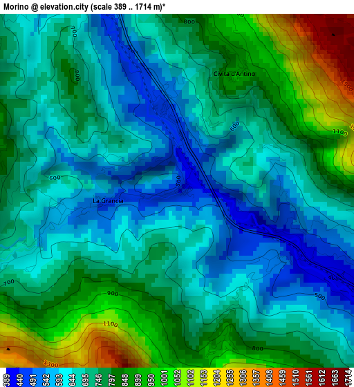
Below is the Elevation map of Morino, which displays elevation range with different colors. Scale of the first map is from 389 to 1714 m (1276 to 5623 ft) with average elevation of 739.4 meters (=2426 ft) [note 1]
These maps also provides idea of topography and contour of this city, they are displayed at different zoom levels. More info about maps, scale and edge coordinates you can find below images.
| \ | Map #1 | Topo.Map |
| Scale [m] | 389..1714 m | × |
| Scale [ft] | 1276..5623 ft | × |
| Average | 739.4 m = 2426 ft | × |
| Width | 7.28 km = 4.5 mi | 232.9 km = 144.7 mi |
| Height | 7.28 km = 4.5 mi | 232.9 km = 144.7 mi |
| ↑Max Latitude | 41.897139° | 42.9031° |
| Latitude at center | 41.86442° | 41.86442° |
| ↓Min Latitude | 41.831684° | 40.80858° |
| ← Min Longitude | 13.413055° | 12.05075° |
| Longitude center | 13.457° | 13.457° |
| →Max Longitude | 13.500945° | 14.86325° |
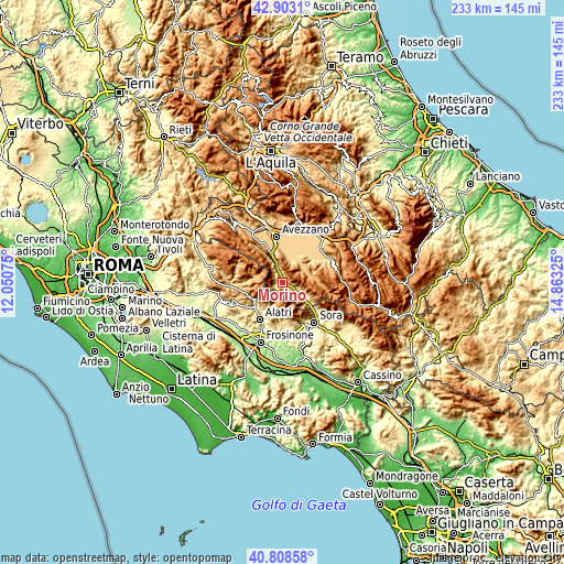
Nearby cities:
Cities around Morino sort by population:
• Trasacco elevation 688 m
12.1 km,  31°
31°
• Luco dei Marsi 662 m
10.6 km,  7°
7°
• Capistrello 732 m
13 km,  337°
337°
• Balsorano 356 m
10.5 km,  125°
125°
• Civitella Roveto 530 m
6.1 km,  333°
333°
• Balsorano Nuovo 355 m
10.6 km, 125°
• Collelongo 895 m
10.8 km,  76°
76°
• Roccavivi 474 m
8.8 km, 131°
• Canistro Inferiore 556 m
9.3 km, 336°
• Filettino 1031 m
11.3 km,  285°
285°
• Civita d'Antino 895 m
2.7 km, 27°
• San Vincenzo Valle Roveto 568 m
6.9 km,  108°
108°
Multilingual:
 En español:
Morino elevación 441 m.
 En France:
Morino élévation 441 m.


Sources and notes:
- [note 1] Map square and city borders are not equal. Map elevation data is calculated only from area inside that square.
- [src 1] Elevation data from geonames database provided with same terms of usage.
- [src 2] The elevation map of Morino is generated using elevation data from NASA's 3 arcsec (90m) resolution SRTM data.
- [src 3] Base (background) map © OpenStreetMap contributors tiles are generated by Geofabrik and OpenTopoMap.
Copyright & License:
This Morino Elevation Map is licensed under CC BY-SA. You may reuse any part from this page, if you give a proper credit by linking to this URL:
 More info on terms of use page.