Curti elevation
Curti (Campania, Provincia di Caserta), Italy elevation is 43 meters and Curti elevation in feet is 141 ft above sea level [src 1]. Curti is a seat of a third-order administrative division (feature code) with elevation that is 279 meters (915 ft) smaller than average city elevation in Italy.
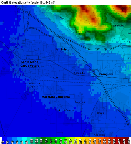
Below is the Elevation map of Curti, which displays elevation range with different colors. Scale of the first map is from 16 to 445 m (52 to 1460 ft) with average elevation of 63.6 meters (=209 ft) [note 1]
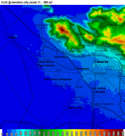
These maps also provides idea of topography and contour of this city, they are displayed at different zoom levels. More info about maps, scale and edge coordinates you can find below images.
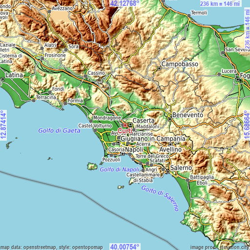
| \ | Map #1 | Map #2 | Topo.Map |
| Scale [m] | 16..445 m | 11..588 m | × |
| Scale [ft] | 52..1460 ft | 36..1929 ft | × |
| Average | 63.6 m = 209 ft | 71.3 m = 234 ft | × |
| Width | 7.37 km = 4.6 mi | 14.73 km = 9.2 mi | 235.7 km = 146.5 mi |
| Height | 7.37 km = 4.6 mi | 14.73 km = 9.2 mi | 235.7 km = 146.5 mi |
| ↑Max Latitude | 41.109279° | 41.142382° | 42.12768° |
| Latitude at center | 41.07616° | 41.07616° | 41.07616° |
| ↓Min Latitude | 41.043024° | 41.009871° | 40.00754° |
| ← Min Longitude | 14.236445° | 14.192499° | 12.87414° |
| Longitude center | 14.28039° | 14.28039° | 14.28039° |
| →Max Longitude | 14.324335° | 14.368281° | 15.68664° |
Nearby cities:
Cities around Curti sort by population:
• Caserta elevation 72 m
4.4 km,  95°
95°
• Santa Maria Capua Vetere 42 m
2.3 km,  284°
284°
• San Nicola la Strada 56 m
5.2 km,  120°
120°
• Casagiove 58 m
2.7 km, 101°
• San Prisco 47 m
1.1 km,  344°
344°
• Macerata Campania 38 m
1.5 km,  189°
189°
• Capodrise 32 m
4.3 km,  149°
149°
• Casapulla 47 m
0.7 km,  85°
85°
• Recale 43 m
2.8 km,  138°
138°
• Portico di Caserta 34 m
2.3 km,  180°
180°
• San Tammaro 28 m
4.1 km,  269°
269°
• Sant'Angelo in Formis 41 m
5.2 km,  330°
330°
Multilingual:
 En español:
Curti elevación 43 m.
 En France:
Curti élévation 43 m.


Sources and notes:
- [note 1] Map square and city borders are not equal. Map elevation data is calculated only from area inside that square.
- [src 1] Elevation data from geonames database provided with same terms of usage.
- [src 2] The elevation map of Curti is generated using elevation data from NASA's 3 arcsec (90m) resolution SRTM data.
- [src 3] Base (background) map © OpenStreetMap contributors tiles are generated by Geofabrik and OpenTopoMap.
Copyright & License:
This Curti Elevation Map is licensed under CC BY-SA. You may reuse any part from this page, if you give a proper credit by linking to this URL:
 More info on terms of use page.