Trezzo Tinella elevation
Trezzo Tinella (Piedmont, Provincia di Cuneo), Italy elevation is 332 meters and Trezzo Tinella elevation in feet is 1089 ft above sea level [src 1]. Trezzo Tinella is a seat of a third-order administrative division (feature code) with elevation that is 10 meters (33 ft) bigger than average city elevation in Italy.
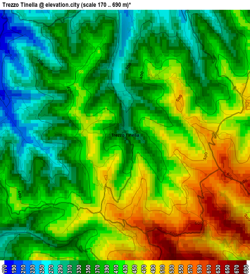
Below is the Elevation map of Trezzo Tinella, which displays elevation range with different colors. Scale of the first map is from 170 to 690 m (558 to 2264 ft) with average elevation of 402 meters (=1319 ft) [note 1]
These maps also provides idea of topography and contour of this city, they are displayed at different zoom levels. More info about maps, scale and edge coordinates you can find below images.
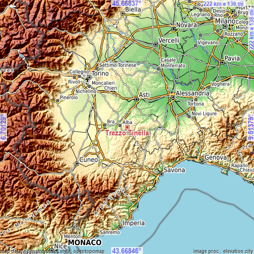
| \ | Map #1 | Topo.Map |
| Scale [m] | 170..690 m | × |
| Scale [ft] | 558..2264 ft | × |
| Average | 402 m = 1319 ft | × |
| Width | 6.95 km = 4.3 mi | 222.4 km = 138.2 mi |
| Height | 6.95 km = 4.3 mi | 222.4 km = 138.2 mi |
| ↑Max Latitude | 44.70828° | 45.66837° |
| Latitude at center | 44.67704° | 44.67704° |
| ↓Min Latitude | 44.645783° | 43.66846° |
| ← Min Longitude | 8.063595° | 6.70129° |
| Longitude center | 8.10754° | 8.10754° |
| →Max Longitude | 8.151485° | 9.51379° |
Nearby cities:
Cities around Trezzo Tinella sort by population:
• Alba elevation 178 m
6.3 km,  293°
293°
• Neive-Borgonovo 236 m
5.3 km,  8°
8°
• Ricca 217 m
5.2 km,  250°
250°
• Rodello 528 m
6.7 km,  216°
216°
• Mango 493 m
3.5 km,  69°
69°
• Treiso 411 m
2.1 km,  312°
312°
• Barbaresco 250 m
5.5 km,  338°
338°
• Benevello 655 m
5.3 km,  182°
182°
• Coazzolo 275 m
6.4 km,  27°
27°
• Neviglie 453 m
1.8 km,  23°
23°
• Bricco di Neive 305 m
4.4 km, 28°
• Borgomale 454 m
6.6 km,  162°
162°
Multilingual:
 En español:
Trezzo Tinella elevación 332 m.
 En France:
Trezzo Tinella élévation 332 m.
 Auf Deutsch:
Trezzo Tinella höhe über dem Meeresspiegel ist 332 m.

Sources and notes:
- [note 1] Map square and city borders are not equal. Map elevation data is calculated only from area inside that square.
- [src 1] Elevation data from geonames database provided with same terms of usage.
- [src 2] The elevation map of Trezzo Tinella is generated using elevation data from NASA's 3 arcsec (90m) resolution SRTM data.
- [src 3] Base (background) map © OpenStreetMap contributors tiles are generated by Geofabrik and OpenTopoMap.
Copyright & License:
This Trezzo Tinella Elevation Map is licensed under CC BY-SA. You may reuse any part from this page, if you give a proper credit by linking to this URL:
 More info on terms of use page.