Roccasparvera elevation
Roccasparvera (Piedmont, Provincia di Cuneo), Italy elevation is 674 meters and Roccasparvera elevation in feet is 2211 ft above sea level [src 1]. Roccasparvera is a seat of a third-order administrative division (feature code) with elevation that is 352 meters (1155 ft) bigger than average city elevation in Italy.
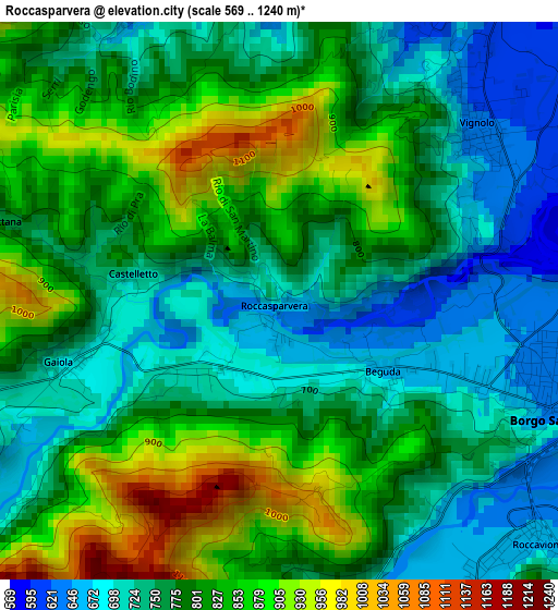
Below is the Elevation map of Roccasparvera, which displays elevation range with different colors. Scale of the first map is from 569 to 1240 m (1867 to 4068 ft) with average elevation of 788.3 meters (=2586 ft) [note 1]
These maps also provides idea of topography and contour of this city, they are displayed at different zoom levels. More info about maps, scale and edge coordinates you can find below images.
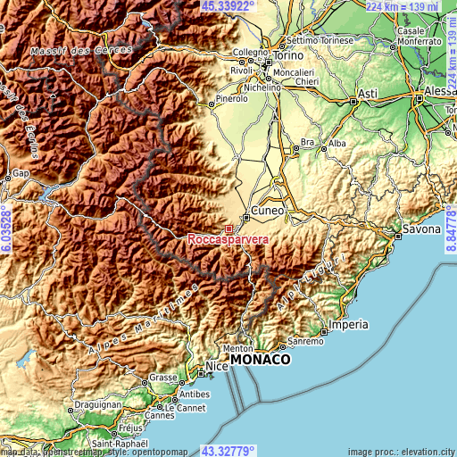
| \ | Map #1 | Topo.Map |
| Scale [m] | 569..1240 m | × |
| Scale [ft] | 1867..4068 ft | × |
| Average | 788.3 m = 2586 ft | × |
| Width | 6.99 km = 4.3 mi | 223.7 km = 139 mi |
| Height | 6.99 km = 4.3 mi | 223.6 km = 138.9 mi |
| ↑Max Latitude | 44.37355° | 45.33922° |
| Latitude at center | 44.34213° | 44.34213° |
| ↓Min Latitude | 44.310693° | 43.32779° |
| ← Min Longitude | 7.397585° | 6.03528° |
| Longitude center | 7.44153° | 7.44153° |
| →Max Longitude | 7.485475° | 8.84778° |
Nearby cities:
Cities around Roccasparvera sort by population:
• Borgo San Dalmazzo elevation 630 m
4.1 km,  96°
96°
• Roccavione 656 m
4.3 km,  137°
137°
• Robilante 682 m
7.9 km,  133°
133°
• Bernezzo 574 m
4.8 km,  355°
355°
• Vignolo 619 m
3.4 km,  45°
45°
• San Rocco 557 m
6.5 km,  22°
22°
• Cervasca 580 m
4.9 km,  28°
28°
• San Defendente 567 m
6.7 km,  35°
35°
• Gaiola 693 m
2.7 km,  254°
254°
• Moiola 691 m
4.7 km,  240°
240°
• Valloriate 785 m
5.4 km,  264°
264°
• Rittana 760 m
3.6 km,  286°
286°
Multilingual:
 En español:
Roccasparvera elevación 674 m.
 En France:
Roccasparvera élévation 674 m.
 Auf Deutsch:
Roccasparvera höhe über dem Meeresspiegel ist 674 m.

Sources and notes:
- [note 1] Map square and city borders are not equal. Map elevation data is calculated only from area inside that square.
- [src 1] Elevation data from geonames database provided with same terms of usage.
- [src 2] The elevation map of Roccasparvera is generated using elevation data from NASA's 3 arcsec (90m) resolution SRTM data.
- [src 3] Base (background) map © OpenStreetMap contributors tiles are generated by Geofabrik and OpenTopoMap.
Copyright & License:
This Roccasparvera Elevation Map is licensed under CC BY-SA. You may reuse any part from this page, if you give a proper credit by linking to this URL:
 More info on terms of use page.