Montirone elevation
Montirone (Lombardy, Provincia di Brescia), Italy elevation is 101 meters and Montirone elevation in feet is 331 ft above sea level [src 1]. Montirone is a seat of a third-order administrative division (feature code) with elevation that is 221 meters (725 ft) smaller than average city elevation in Italy.
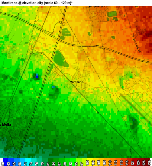
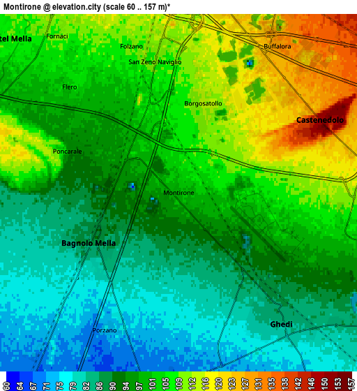
Below is the Elevation map of Montirone, which displays elevation range with different colors. Scale of the first map is from 60 to 129 m (197 to 423 ft) with average elevation of 97.2 meters (=319 ft) [note 1]
These maps also provides idea of topography and contour of this city, they are displayed at different zoom levels. More info about maps, scale and edge coordinates you can find below images.
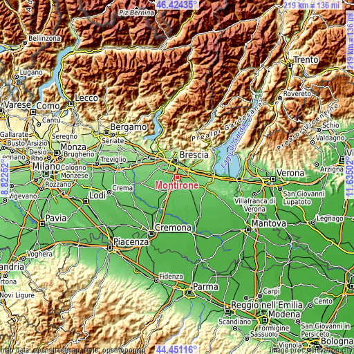
| \ | Map #1 | Map #2 | Topo.Map |
| Scale [m] | 60..129 m | 60..157 m | × |
| Scale [ft] | 197..423 ft | 197..515 ft | × |
| Average | 97.2 m = 319 ft | 97.8 m = 321 ft | × |
| Width | 6.86 km = 4.3 mi | 13.71 km = 8.5 mi | 219.4 km = 136.3 mi |
| Height | 6.86 km = 4.3 mi | 13.71 km = 8.5 mi | 219.4 km = 136.3 mi |
| ↑Max Latitude | 45.477203° | 45.508008° | 46.42435° |
| Latitude at center | 45.44638° | 45.44638° | 45.44638° |
| ↓Min Latitude | 45.415541° | 45.384684° | 44.45116° |
| ← Min Longitude | 10.184825° | 10.140879° | 8.82252° |
| Longitude center | 10.22877° | 10.22877° | 10.22877° |
| →Max Longitude | 10.272715° | 10.316661° | 11.63502° |
Nearby cities:
Cities around Montirone sort by population:
• Ghedi elevation 85 m
6.2 km,  142°
142°
• Bagnolo Mella 86 m
3.9 km,  237°
237°
• Castel Mella 108 m
8.7 km,  312°
312°
• Leno 65 m
8.6 km,  186°
186°
• Borgosatollo 115 m
3.5 km,  14°
14°
• Castenedolo 127 m
5.8 km,  57°
57°
• Flero 105 m
5.7 km, 314°
• Poncarale 95 m
4.1 km,  292°
292°
• San Zeno Naviglio 109 m
5.2 km,  351°
351°
• Capriano del Colle 97 m
8.2 km, 292°
• Buffalora-Bettole 128 m
6.7 km,  32°
32°
• Folzano 107 m
5.8 km,  342°
342°
Multilingual:
 En español:
Montirone elevación 101 m.
 En France:
Montirone élévation 101 m.
 Auf Deutsch:
Montirone höhe über dem Meeresspiegel ist 101 m.

Sources and notes:
- [note 1] Map square and city borders are not equal. Map elevation data is calculated only from area inside that square.
- [src 1] Elevation data from geonames database provided with same terms of usage.
- [src 2] The elevation map of Montirone is generated using elevation data from NASA's 3 arcsec (90m) resolution SRTM data.
- [src 3] Base (background) map © OpenStreetMap contributors tiles are generated by Geofabrik and OpenTopoMap.
Copyright & License:
This Montirone Elevation Map is licensed under CC BY-SA. You may reuse any part from this page, if you give a proper credit by linking to this URL:
 More info on terms of use page.