Montelibretti elevation
Montelibretti (Latium, Città metropolitana di Roma Capitale), Italy elevation is 230 meters and Montelibretti elevation in feet is 755 ft above sea level [src 1]. Montelibretti is a seat of a third-order administrative division (feature code) with elevation that is 92 meters (302 ft) smaller than average city elevation in Italy.
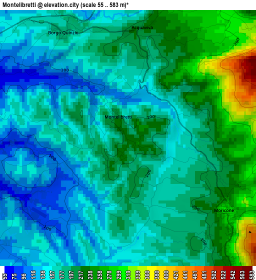
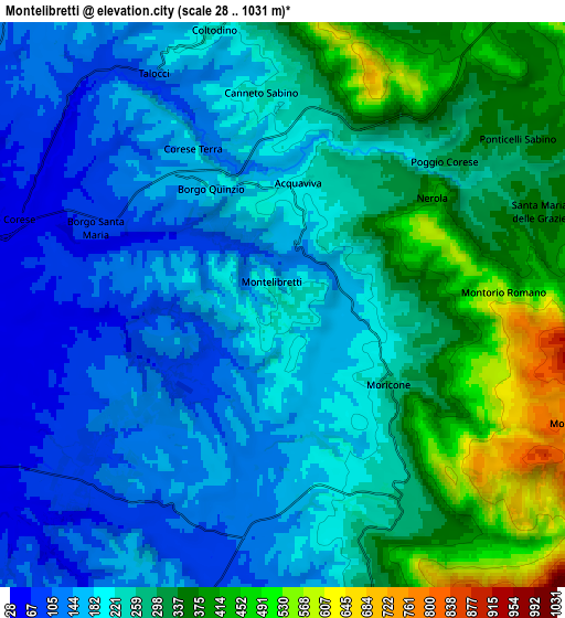
Below is the Elevation map of Montelibretti, which displays elevation range with different colors. Scale of the first map is from 55 to 583 m (180 to 1913 ft) with average elevation of 187.1 meters (=614 ft) [note 1]
These maps also provides idea of topography and contour of this city, they are displayed at different zoom levels. More info about maps, scale and edge coordinates you can find below images.
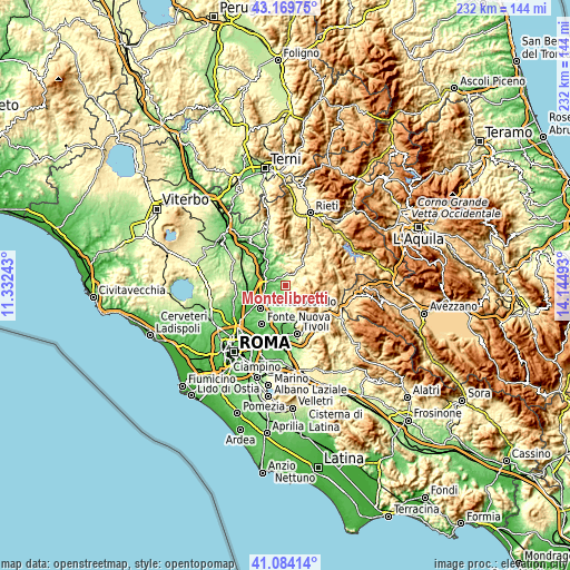
| \ | Map #1 | Map #2 | Topo.Map |
| Scale [m] | 55..583 m | 28..1031 m | × |
| Scale [ft] | 180..1913 ft | 92..3383 ft | × |
| Average | 187.1 m = 614 ft | 245.8 m = 806 ft | × |
| Width | 7.25 km = 4.5 mi | 14.49 km = 9 mi | 231.9 km = 144.1 mi |
| Height | 7.25 km = 4.5 mi | 14.49 km = 9 mi | 231.9 km = 144.1 mi |
| ↑Max Latitude | 42.16811° | 42.200673° | 43.16975° |
| Latitude at center | 42.13553° | 42.13553° | 42.13553° |
| ↓Min Latitude | 42.102934° | 42.07032° | 41.08414° |
| ← Min Longitude | 12.694735° | 12.650789° | 11.33243° |
| Longitude center | 12.73868° | 12.73868° | 12.73868° |
| →Max Longitude | 12.782625° | 12.826571° | 14.14493° |
Nearby cities:
Cities around Montelibretti sort by population:
• Palombara Sabina elevation 297 m
7.7 km,  162°
162°
• Moricone 293 m
3.5 km,  127°
127°
• Montorio Romano 569 m
5.4 km,  87°
87°
• Castel Chiodato 171 m
9.5 km,  200°
200°
• Monteflavio 804 m
8.1 km,  110°
110°
• Scandriglia 486 m
8.9 km,  71°
71°
• Cretone 150 m
7.7 km, 201°
• Nerola 425 m
4.7 km,  54°
54°
• Poggio Nativo 419 m
10.3 km,  27°
27°
• Toffia 264 m
8.7 km,  8°
8°
• Castelnuovo di Farfa 355 m
10.7 km,  1°
1°
• Fara in Sabina 469 m
8.1 km,  354°
354°
Multilingual:
 En español:
Montelibretti elevación 230 m.
 En France:
Montelibretti élévation 230 m.
 Auf Deutsch:
Montelibretti höhe über dem Meeresspiegel ist 230 m.

Sources and notes:
- [note 1] Map square and city borders are not equal. Map elevation data is calculated only from area inside that square.
- [src 1] Elevation data from geonames database provided with same terms of usage.
- [src 2] The elevation map of Montelibretti is generated using elevation data from NASA's 3 arcsec (90m) resolution SRTM data.
- [src 3] Base (background) map © OpenStreetMap contributors tiles are generated by Geofabrik and OpenTopoMap.
Copyright & License:
This Montelibretti Elevation Map is licensed under CC BY-SA. You may reuse any part from this page, if you give a proper credit by linking to this URL:
 More info on terms of use page.