Bonate Sotto elevation
Bonate Sotto (Lombardy, Provincia di Bergamo), Italy elevation is 215 meters and Bonate Sotto elevation in feet is 705 ft above sea level [src 1]. Bonate Sotto is a seat of a third-order administrative division (feature code) with elevation that is 107 meters (351 ft) smaller than average city elevation in Italy.
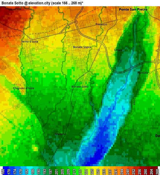
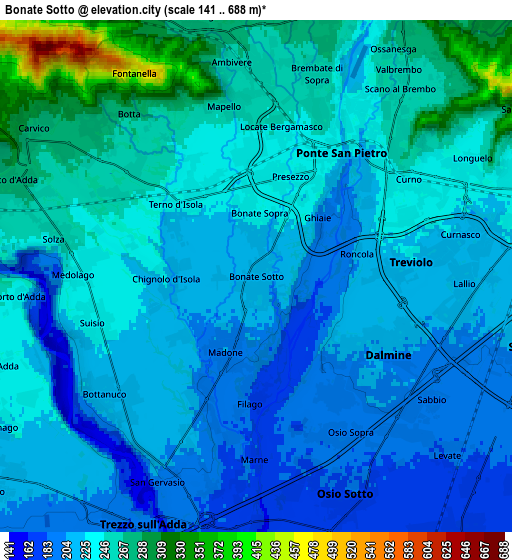
Below is the Elevation map of Bonate Sotto, which displays elevation range with different colors. Scale of the first map is from 166 to 268 m (545 to 879 ft) with average elevation of 213.4 meters (=700 ft) [note 1]
These maps also provides idea of topography and contour of this city, they are displayed at different zoom levels. More info about maps, scale and edge coordinates you can find below images.
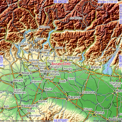
| \ | Map #1 | Map #2 | Topo.Map |
| Scale [m] | 166..268 m | 141..688 m | × |
| Scale [ft] | 545..879 ft | 463..2257 ft | × |
| Average | 213.4 m = 700 ft | 233.8 m = 767 ft | × |
| Width | 6.83 km = 4.2 mi | 13.66 km = 8.5 mi | 218.5 km = 135.8 mi |
| Height | 6.83 km = 4.2 mi | 13.66 km = 8.5 mi | 218.5 km = 135.8 mi |
| ↑Max Latitude | 45.698881° | 45.729565° | 46.64226° |
| Latitude at center | 45.66818° | 45.66818° | 45.66818° |
| ↓Min Latitude | 45.637462° | 45.606727° | 44.67685° |
| ← Min Longitude | 9.514705° | 9.470759° | 8.1524° |
| Longitude center | 9.55865° | 9.55865° | 9.55865° |
| →Max Longitude | 9.602595° | 9.646541° | 10.9649° |
Nearby cities:
Cities around Bonate Sotto sort by population:
• Dalmine elevation 205 m
4.2 km,  119°
119°
• Treviolo 226 m
4.2 km,  81°
81°
• Terno d'Isola 230 m
2.9 km,  311°
311°
• Curno 243 m
4.5 km,  59°
59°
• Bonate Sopra 228 m
1.5 km,  2°
2°
• Presezzo 235 m
2.8 km,  18°
18°
• Madone 202 m
2.1 km,  198°
198°
• Suisio 233 m
4.6 km,  254°
254°
• Chignolo d'Isola 227 m
2.4 km,  268°
268°
• Filago 181 m
3.4 km,  183°
183°
• Medolago 242 m
4.7 km, 274°
• Ghiaie 200 m
2.3 km,  48°
48°
Multilingual:
 En español:
Bonate Sotto elevación 215 m.
 En France:
Bonate Sotto élévation 215 m.
 Auf Deutsch:
Bonate Sotto höhe über dem Meeresspiegel ist 215 m.

Sources and notes:
- [note 1] Map square and city borders are not equal. Map elevation data is calculated only from area inside that square.
- [src 1] Elevation data from geonames database provided with same terms of usage.
- [src 2] The elevation map of Bonate Sotto is generated using elevation data from NASA's 3 arcsec (90m) resolution SRTM data.
- [src 3] Base (background) map © OpenStreetMap contributors tiles are generated by Geofabrik and OpenTopoMap.
Copyright & License:
This Bonate Sotto Elevation Map is licensed under CC BY-SA. You may reuse any part from this page, if you give a proper credit by linking to this URL:
 More info on terms of use page.