Curno elevation
Curno (Lombardy, Provincia di Bergamo), Italy elevation is 243 meters and Curno elevation in feet is 797 ft above sea level [src 1]. Curno is a seat of a third-order administrative division (feature code) with elevation that is 79 meters (259 ft) smaller than average city elevation in Italy.
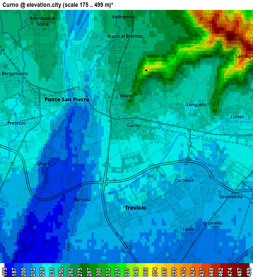
Below is the Elevation map of Curno, which displays elevation range with different colors. Scale of the first map is from 175 to 499 m (574 to 1637 ft) with average elevation of 238.5 meters (=782 ft) [note 1]
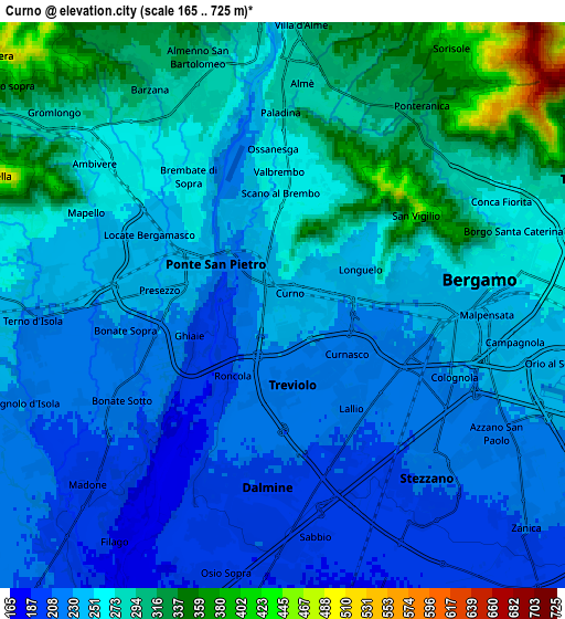
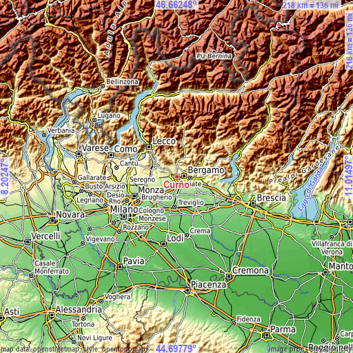
These maps also provides idea of topography and contour of this city, they are displayed at different zoom levels. More info about maps, scale and edge coordinates you can find below images.
| \ | Map #1 | Map #2 | Topo.Map |
| Scale [m] | 175..499 m | 165..725 m | × |
| Scale [ft] | 574..1637 ft | 541..2379 ft | × |
| Average | 238.5 m = 782 ft | 257.4 m = 844 ft | × |
| Width | 6.83 km = 4.2 mi | 13.65 km = 8.5 mi | 218.5 km = 135.8 mi |
| Height | 6.83 km = 4.2 mi | 13.65 km = 8.5 mi | 218.4 km = 135.7 mi |
| ↑Max Latitude | 45.71945° | 45.750123° | 46.66248° |
| Latitude at center | 45.68876° | 45.68876° | 45.68876° |
| ↓Min Latitude | 45.658053° | 45.62733° | 44.69779° |
| ← Min Longitude | 9.564775° | 9.520829° | 8.20247° |
| Longitude center | 9.60872° | 9.60872° | 9.60872° |
| →Max Longitude | 9.652665° | 9.696611° | 11.01497° |
Nearby cities:
Cities around Curno sort by population:
• Bergamo elevation 260 m
4.6 km,  79°
79°
• Dalmine 205 m
4.4 km,  182°
182°
• Ponte San Pietro 231 m
2.4 km,  323°
323°
• Treviolo 226 m
1.7 km,  171°
171°
• Brembate di Sopra 264 m
3.8 km, 323°
• Mozzo 254 m
1.1 km,  359°
359°
• Bonate Sopra 228 m
3.9 km,  258°
258°
• Bonate Sotto 215 m
4.5 km,  239°
239°
• Presezzo 235 m
3 km,  277°
277°
• Lallio 212 m
3.3 km,  151°
151°
• Scano al Brembo 266 m
3.3 km,  0°
0°
• Ghiaie 200 m
2.3 km,  250°
250°
Multilingual:
 En español:
Curno elevación 243 m.
 En France:
Curno élévation 243 m.


Sources and notes:
- [note 1] Map square and city borders are not equal. Map elevation data is calculated only from area inside that square.
- [src 1] Elevation data from geonames database provided with same terms of usage.
- [src 2] The elevation map of Curno is generated using elevation data from NASA's 3 arcsec (90m) resolution SRTM data.
- [src 3] Base (background) map © OpenStreetMap contributors tiles are generated by Geofabrik and OpenTopoMap.
Copyright & License:
This Curno Elevation Map is licensed under CC BY-SA. You may reuse any part from this page, if you give a proper credit by linking to this URL:
 More info on terms of use page.