Veniano elevation
Veniano (Lombardy, Provincia di Como), Italy elevation is 331 meters and Veniano elevation in feet is 1086 ft above sea level [src 1]. Veniano is a seat of a third-order administrative division (feature code) with elevation that is 9 meters (30 ft) bigger than average city elevation in Italy.
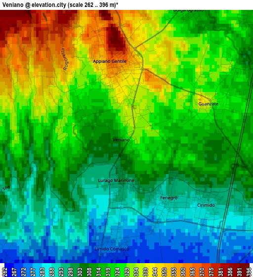
Below is the Elevation map of Veniano, which displays elevation range with different colors. Scale of the first map is from 262 to 396 m (860 to 1299 ft) with average elevation of 316 meters (=1037 ft) [note 1]
These maps also provides idea of topography and contour of this city, they are displayed at different zoom levels. More info about maps, scale and edge coordinates you can find below images.
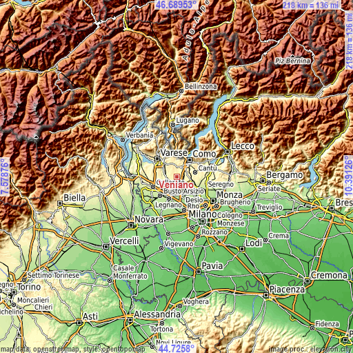
| \ | Map #1 | Topo.Map |
| Scale [m] | 262..396 m | × |
| Scale [ft] | 860..1299 ft | × |
| Average | 316 m = 1037 ft | × |
| Width | 6.82 km = 4.2 mi | 218.3 km = 135.6 mi |
| Height | 6.82 km = 4.2 mi | 218.3 km = 135.6 mi |
| ↑Max Latitude | 45.746965° | 46.68953° |
| Latitude at center | 45.71629° | 45.71629° |
| ↓Min Latitude | 45.685598° | 44.7258° |
| ← Min Longitude | 8.941065° | 7.57876° |
| Longitude center | 8.98501° | 8.98501° |
| →Max Longitude | 9.028955° | 10.39126° |
Nearby cities:
Cities around Veniano sort by population:
• Lomazzo elevation 292 m
4.4 km,  119°
119°
• Appiano Gentile 369 m
2.1 km,  351°
351°
• Cadorago-Caslino al Piano 315 m
4.3 km,  73°
73°
• Guanzate 319 m
3 km, 65°
• Bulgarograsso 319 m
3.8 km,  25°
25°
• Fenegrò 295 m
2 km,  145°
145°
• Carbonate 269 m
5 km,  226°
226°
• Limido Comasco 277 m
3 km,  187°
187°
• Cassina Rizzardi 323 m
5 km,  37°
37°
• Lurago Marinone 301 m
1.3 km, 185°
• Oltrona di San Mamette 374 m
4.4 km, 351°
• Cirimido 293 m
2.8 km,  130°
130°
Multilingual:
 En español:
Veniano elevación 331 m.
 En France:
Veniano élévation 331 m.


Sources and notes:
- [note 1] Map square and city borders are not equal. Map elevation data is calculated only from area inside that square.
- [src 1] Elevation data from geonames database provided with same terms of usage.
- [src 2] The elevation map of Veniano is generated using elevation data from NASA's 3 arcsec (90m) resolution SRTM data.
- [src 3] Base (background) map © OpenStreetMap contributors tiles are generated by Geofabrik and OpenTopoMap.
Copyright & License:
This Veniano Elevation Map is licensed under CC BY-SA. You may reuse any part from this page, if you give a proper credit by linking to this URL:
 More info on terms of use page.