Agerola elevation
Agerola (Campania, Napoli), Italy elevation is 670 meters and Agerola elevation in feet is 2198 ft above sea level [src 1]. Agerola is a seat of a third-order administrative division (feature code) with elevation that is 348 meters (1142 ft) bigger than average city elevation in Italy.
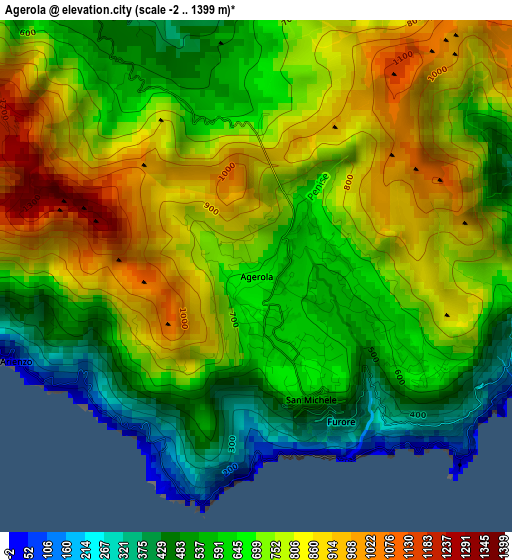
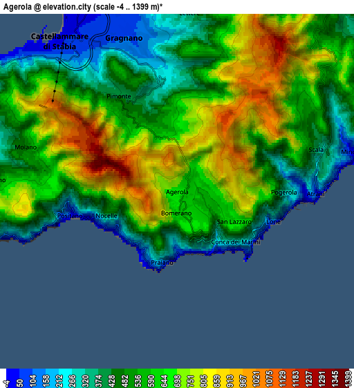
Below is the Elevation map of Agerola, which displays elevation range with different colors. Scale of the first map is from -2 to 1399 m (-7 to 4590 ft) with average elevation of 703.2 meters (=2307 ft) [note 1]
These maps also provides idea of topography and contour of this city, they are displayed at different zoom levels. More info about maps, scale and edge coordinates you can find below images.
| \ | Map #1 | Map #2 | Topo.Map |
| Scale [m] | -2..1399 m | -4..1399 m | × |
| Scale [ft] | -7..4590 ft | -13..4590 ft | × |
| Average | 703.2 m = 2307 ft | 589.9 m = 1935 ft | × |
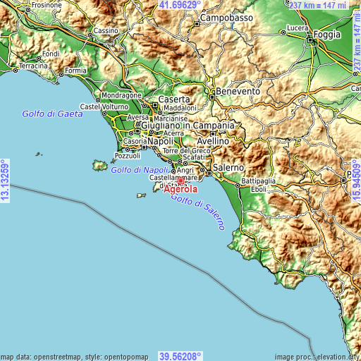
| Width | 7.42 km = 4.6 mi | 14.83 km = 9.2 mi | 237.3 km = 147.5 mi |
| Height | 7.42 km = 4.6 mi | 14.83 km = 9.2 mi | 237.3 km = 147.5 mi |
| ↑Max Latitude | 40.671049° | 40.704372° | 41.69629° |
| Latitude at center | 40.63771° | 40.63771° | 40.63771° |
| ↓Min Latitude | 40.604354° | 40.570982° | 39.56208° |
| ← Min Longitude | 14.494895° | 14.450949° | 13.13259° |
| Longitude center | 14.53884° | 14.53884° | 14.53884° |
| →Max Longitude | 14.582785° | 14.626731° | 15.94509° |
Nearby cities:
Cities around Agerola sort by population:
• Gragnano elevation 124 m
5.9 km,  344°
344°
• Pianillo 585 m
1 km,  114°
114°
• Pimonte 415 m
4.7 km,  328°
328°
• Amalfi 25 m
5.4 km,  93°
93°
• Piazza-Tralia-Pendolo 433 m
4.9 km,  323°
323°
• Positano 120 m
4.7 km,  257°
257°
• Praiano 179 m
3.1 km,  202°
202°
• Franche 390 m
4.1 km, 338°
• Atrani 11 m
6 km, 91°
• Furore 521 m
2.1 km,  155°
155°
• Conca dei Marini 179 m
3.7 km,  127°
127°
• San Michele 461 m
2.2 km,  153°
153°
Multilingual:
 En español:
Agerola elevación 670 m.
 En France:
Agerola élévation 670 m.


Sources and notes:
- [note 1] Map square and city borders are not equal. Map elevation data is calculated only from area inside that square.
- [src 1] Elevation data from geonames database provided with same terms of usage.
- [src 2] The elevation map of Agerola is generated using elevation data from NASA's 3 arcsec (90m) resolution SRTM data.
- [src 3] Base (background) map © OpenStreetMap contributors tiles are generated by Geofabrik and OpenTopoMap.
Copyright & License:
This Agerola Elevation Map is licensed under CC BY-SA. You may reuse any part from this page, if you give a proper credit by linking to this URL:
 More info on terms of use page.