Airola elevation
Airola (Campania, Provincia di Benevento), Italy elevation is 262 meters and Airola elevation in feet is 860 ft above sea level [src 1]. Airola is a seat of a third-order administrative division (feature code) with elevation that is 60 meters (197 ft) smaller than average city elevation in Italy.
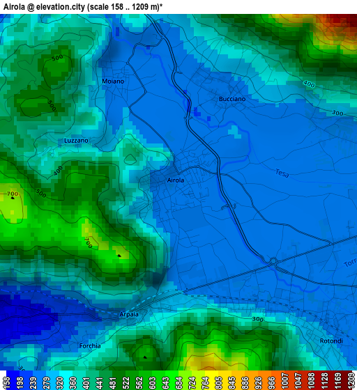
Below is the Elevation map of Airola, which displays elevation range with different colors. Scale of the first map is from 158 to 1209 m (518 to 3967 ft) with average elevation of 361.7 meters (=1187 ft) [note 1]
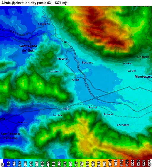
These maps also provides idea of topography and contour of this city, they are displayed at different zoom levels. More info about maps, scale and edge coordinates you can find below images.
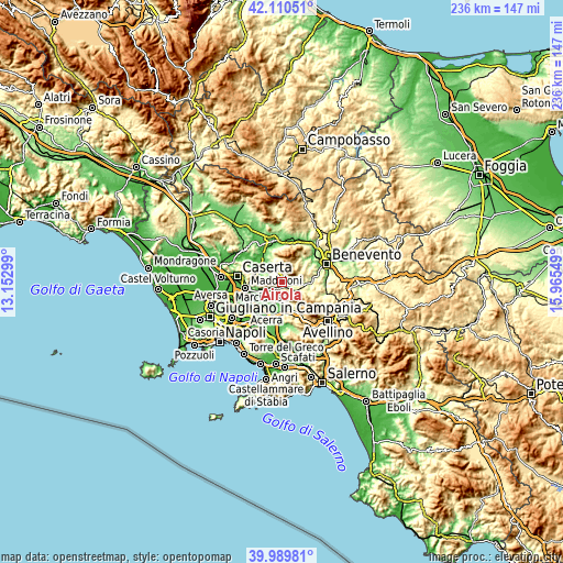
| \ | Map #1 | Map #2 | Topo.Map |
| Scale [m] | 158..1209 m | 63..1371 m | × |
| Scale [ft] | 518..3967 ft | 207..4498 ft | × |
| Average | 361.7 m = 1187 ft | 453.5 m = 1488 ft | × |
| Width | 7.37 km = 4.6 mi | 14.74 km = 9.2 mi | 235.8 km = 146.5 mi |
| Height | 7.37 km = 4.6 mi | 14.74 km = 9.2 mi | 235.8 km = 146.5 mi |
| ↑Max Latitude | 41.091838° | 41.124949° | 42.11051° |
| Latitude at center | 41.05871° | 41.05871° | 41.05871° |
| ↓Min Latitude | 41.025565° | 40.992404° | 39.98981° |
| ← Min Longitude | 14.515295° | 14.471349° | 13.15299° |
| Longitude center | 14.55924° | 14.55924° | 14.55924° |
| →Max Longitude | 14.603185° | 14.647131° | 15.96549° |
Nearby cities:
Cities around Airola sort by population:
• Sant'Agata de'Goti elevation 165 m
6.2 km,  303°
303°
• Cervinara 290 m
6.3 km,  132°
132°
• Trescine 282 m
6.5 km, 128°
• Arienzo 110 m
6.2 km,  235°
235°
• Rotondi 275 m
4.2 km, 133°
• Moiano 267 m
2.6 km,  331°
331°
• Arpaia 307 m
2.5 km,  194°
194°
• Paolisi 267 m
2.9 km,  144°
144°
• Bucciano 261 m
2.2 km,  21°
21°
• Luzzano 298 m
2.2 km, 298°
• Bonea 312 m
5.1 km,  71°
71°
• Forchia 258 m
3.6 km,  213°
213°
Multilingual:
 En español:
Airola elevación 262 m.
 En France:
Airola élévation 262 m.


Sources and notes:
- [note 1] Map square and city borders are not equal. Map elevation data is calculated only from area inside that square.
- [src 1] Elevation data from geonames database provided with same terms of usage.
- [src 2] The elevation map of Airola is generated using elevation data from NASA's 3 arcsec (90m) resolution SRTM data.
- [src 3] Base (background) map © OpenStreetMap contributors tiles are generated by Geofabrik and OpenTopoMap.
Copyright & License:
This Airola Elevation Map is licensed under CC BY-SA. You may reuse any part from this page, if you give a proper credit by linking to this URL:
 More info on terms of use page.