Alberona elevation
Alberona (Apulia, Provincia di Foggia), Italy elevation is 707 meters and Alberona elevation in feet is 2320 ft above sea level [src 1]. Alberona is a seat of a third-order administrative division (feature code) with elevation that is 385 meters (1263 ft) bigger than average city elevation in Italy.
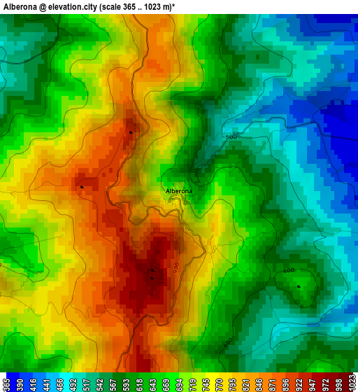
Below is the Elevation map of Alberona, which displays elevation range with different colors. Scale of the first map is from 365 to 1023 m (1198 to 3356 ft) with average elevation of 669.4 meters (=2196 ft) [note 1]
These maps also provides idea of topography and contour of this city, they are displayed at different zoom levels. More info about maps, scale and edge coordinates you can find below images.
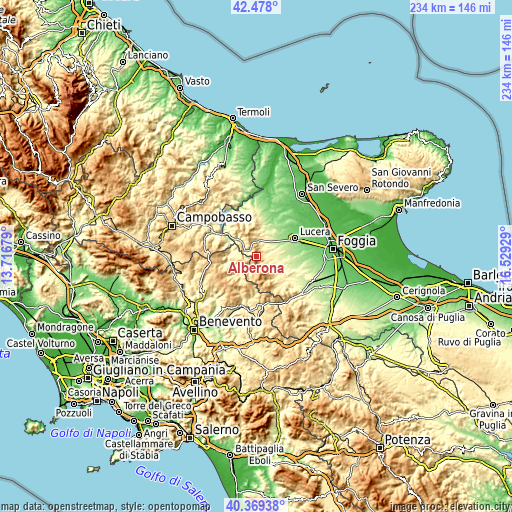
| \ | Map #1 | Topo.Map |
| Scale [m] | 365..1023 m | × |
| Scale [ft] | 1198..3356 ft | × |
| Average | 669.4 m = 2196 ft | × |
| Width | 7.33 km = 4.6 mi | 234.5 km = 145.7 mi |
| Height | 7.33 km = 4.6 mi | 234.4 km = 145.6 mi |
| ↑Max Latitude | 41.465189° | 42.478° |
| Latitude at center | 41.43225° | 41.43225° |
| ↓Min Latitude | 41.399294° | 40.36938° |
| ← Min Longitude | 15.079095° | 13.71679° |
| Longitude center | 15.12304° | 15.12304° |
| →Max Longitude | 15.166985° | 16.52929° |
Nearby cities:
Cities around Alberona sort by population:
• San Bartolomeo in Galdo elevation 607 m
9 km,  258°
258°
• Pietramontecorvino 454 m
12.2 km,  2°
2°
• Biccari 445 m
7.2 km,  122°
122°
• Baselice 621 m
13.2 km,  250°
250°
• Volturino 729 m
5 km, 1°
• Castelluccio Valmaggiore 621 m
11.8 km,  147°
147°
• Roseto Valfortore 724 m
6.6 km,  198°
198°
• San Marco la Catola 656 m
14.2 km,  316°
316°
• Motta Montecorvino 633 m
8.4 km,  354°
354°
• Faeto 819 m
12.3 km,  165°
165°
• Volturara Appula 521 m
9.2 km, 320°
• Celle di San Vito 727 m
12.8 km,  157°
157°
Multilingual:
 En español:
Alberona elevación 707 m.
 En France:
Alberona élévation 707 m.
 Auf Deutsch:
Alberona höhe über dem Meeresspiegel ist 707 m.

Sources and notes:
- [note 1] Map square and city borders are not equal. Map elevation data is calculated only from area inside that square.
- [src 1] Elevation data from geonames database provided with same terms of usage.
- [src 2] The elevation map of Alberona is generated using elevation data from NASA's 3 arcsec (90m) resolution SRTM data.
- [src 3] Base (background) map © OpenStreetMap contributors tiles are generated by Geofabrik and OpenTopoMap.
Copyright & License:
This Alberona Elevation Map is licensed under CC BY-SA. You may reuse any part from this page, if you give a proper credit by linking to this URL:
 More info on terms of use page.