Angri elevation
Angri (Campania, Provincia di Salerno), Italy elevation is 29 meters and Angri elevation in feet is 95 ft above sea level [src 1]. Angri is a seat of a third-order administrative division (feature code) with elevation that is 293 meters (961 ft) smaller than average city elevation in Italy.
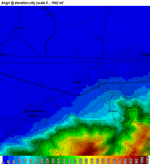
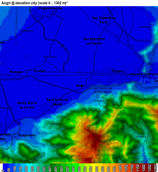
Below is the Elevation map of Angri, which displays elevation range with different colors. Scale of the first map is from 5 to 1042 m (16 to 3419 ft) with average elevation of 128.9 meters (=423 ft) [note 1]
These maps also provides idea of topography and contour of this city, they are displayed at different zoom levels. More info about maps, scale and edge coordinates you can find below images.
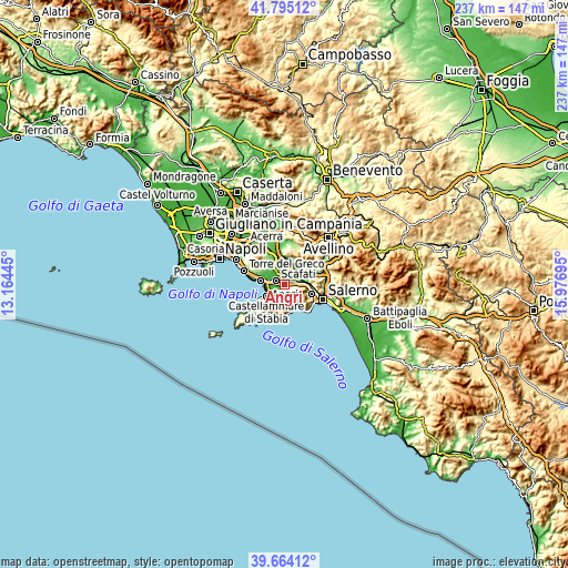
| \ | Map #1 | Map #2 | Topo.Map |
| Scale [m] | 5..1042 m | 0..1302 m | × |
| Scale [ft] | 16..3419 ft | 0..4272 ft | × |
| Average | 128.9 m = 423 ft | 201.3 m = 660 ft | × |
| Width | 7.4 km = 4.6 mi | 14.81 km = 9.2 mi | 236.9 km = 147.2 mi |
| Height | 7.4 km = 4.6 mi | 14.81 km = 9.2 mi | 236.9 km = 147.2 mi |
| ↑Max Latitude | 40.771439° | 40.804711° | 41.79512° |
| Latitude at center | 40.73815° | 40.73815° | 40.73815° |
| ↓Min Latitude | 40.704844° | 40.671522° | 39.66412° |
| ← Min Longitude | 14.526755° | 14.482809° | 13.16445° |
| Longitude center | 14.5707° | 14.5707° | 14.5707° |
| →Max Longitude | 14.614645° | 14.658591° | 15.97695° |
Nearby cities:
Cities around Angri sort by population:
• Scafati elevation 16 m
3.7 km,  311°
311°
• Pagani 43 m
3.7 km,  83°
83°
• Sant'Antonio Abate 17 m
3.2 km,  234°
234°
• Santa Maria La Carità 30 m
5.7 km,  244°
244°
• San Marzano sul Sarno 15 m
4.5 km,  10°
10°
• Sant'Egidio del Monte Albino 51 m
2 km,  88°
88°
• Lettere 353 m
4.3 km,  210°
210°
• Piazza Roma 337 m
4.4 km, 211°
• Casola di Napoli 178 m
5.6 km,  217°
217°
• Corbara 186 m
2.5 km,  133°
133°
• Pietre 399 m
5.9 km,  135°
135°
• San Lorenzo 18 m
2.4 km,  42°
42°
Multilingual:
 En español:
Angri elevación 29 m.
 En France:
Angri élévation 29 m.


Sources and notes:
- [note 1] Map square and city borders are not equal. Map elevation data is calculated only from area inside that square.
- [src 1] Elevation data from geonames database provided with same terms of usage.
- [src 2] The elevation map of Angri is generated using elevation data from NASA's 3 arcsec (90m) resolution SRTM data.
- [src 3] Base (background) map © OpenStreetMap contributors tiles are generated by Geofabrik and OpenTopoMap.
Copyright & License:
This Angri Elevation Map is licensed under CC BY-SA. You may reuse any part from this page, if you give a proper credit by linking to this URL:
 More info on terms of use page.