Arborio elevation
Arborio (Piedmont, Provincia di Vercelli), Italy elevation is 188 meters and Arborio elevation in feet is 617 ft above sea level [src 1]. Arborio is a seat of a third-order administrative division (feature code) with elevation that is 134 meters (440 ft) smaller than average city elevation in Italy.
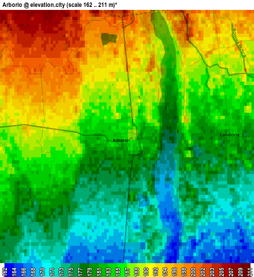
Below is the Elevation map of Arborio, which displays elevation range with different colors. Scale of the first map is from 162 to 211 m (531 to 692 ft) with average elevation of 183.9 meters (=603 ft) [note 1]
These maps also provides idea of topography and contour of this city, they are displayed at different zoom levels. More info about maps, scale and edge coordinates you can find below images.
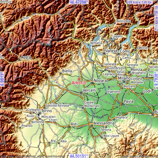
| \ | Map #1 | Topo.Map |
| Scale [m] | 162..211 m | × |
| Scale [ft] | 531..692 ft | × |
| Average | 183.9 m = 603 ft | × |
| Width | 6.85 km = 4.3 mi | 219.2 km = 136.2 mi |
| Height | 6.85 km = 4.3 mi | 219.2 km = 136.2 mi |
| ↑Max Latitude | 45.526656° | 46.47296° |
| Latitude at center | 45.49586° | 45.49586° |
| ↓Min Latitude | 45.465048° | 44.50151° |
| ← Min Longitude | 8.343605° | 6.9813° |
| Longitude center | 8.38755° | 8.38755° |
| →Max Longitude | 8.431495° | 9.7938° |
Nearby cities:
Cities around Arborio sort by population:
• Carpignano Sesia elevation 202 m
4.8 km,  29°
29°
• Recetto 165 m
5.5 km,  137°
137°
• Lenta 224 m
6.8 km,  357°
357°
• Vicolungo 166 m
6.2 km,  111°
111°
• Ghislarengo 204 m
3.6 km, 357°
• Rovasenda 226 m
7.3 km,  310°
310°
• San Nazzaro Sesia 158 m
7.1 km,  155°
155°
• Landiona 184 m
2.7 km,  87°
87°
• Sillavengo 195 m
5 km,  56°
56°
• Greggio 162 m
4.9 km,  182°
182°
• San Giacomo Vercellese 197 m
4.7 km,  273°
273°
• Mandello Vitta 178 m
5.6 km, 90°
Multilingual:
 En español:
Arborio elevación 188 m.
 En France:
Arborio élévation 188 m.


Sources and notes:
- [note 1] Map square and city borders are not equal. Map elevation data is calculated only from area inside that square.
- [src 1] Elevation data from geonames database provided with same terms of usage.
- [src 2] The elevation map of Arborio is generated using elevation data from NASA's 3 arcsec (90m) resolution SRTM data.
- [src 3] Base (background) map © OpenStreetMap contributors tiles are generated by Geofabrik and OpenTopoMap.
Copyright & License:
This Arborio Elevation Map is licensed under CC BY-SA. You may reuse any part from this page, if you give a proper credit by linking to this URL:
 More info on terms of use page.