Vicolungo elevation
Vicolungo (Piedmont, Provincia di Novara), Italy elevation is 166 meters and Vicolungo elevation in feet is 545 ft above sea level [src 1]. Vicolungo is a seat of a third-order administrative division (feature code) with elevation that is 156 meters (512 ft) smaller than average city elevation in Italy.
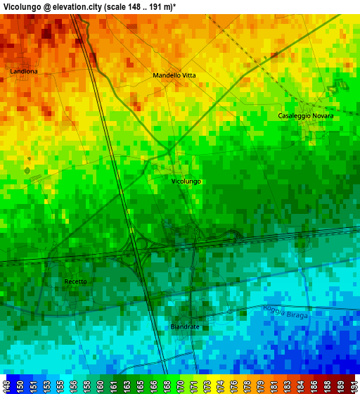
Below is the Elevation map of Vicolungo, which displays elevation range with different colors. Scale of the first map is from 148 to 191 m (486 to 627 ft) with average elevation of 166.1 meters (=545 ft) [note 1]
These maps also provides idea of topography and contour of this city, they are displayed at different zoom levels. More info about maps, scale and edge coordinates you can find below images.
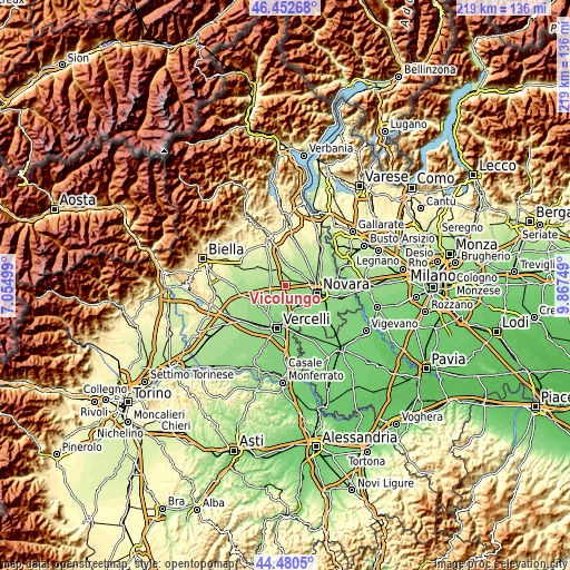
| \ | Map #1 | Topo.Map |
| Scale [m] | 148..191 m | × |
| Scale [ft] | 486..627 ft | × |
| Average | 166.1 m = 545 ft | × |
| Width | 6.85 km = 4.3 mi | 219.3 km = 136.3 mi |
| Height | 6.85 km = 4.3 mi | 219.3 km = 136.3 mi |
| ↑Max Latitude | 45.506027° | 46.45268° |
| Latitude at center | 45.47522° | 45.47522° |
| ↓Min Latitude | 45.444396° | 44.4805° |
| ← Min Longitude | 8.417295° | 7.05499° |
| Longitude center | 8.46124° | 8.46124° |
| →Max Longitude | 8.505185° | 9.86749° |
Nearby cities:
Cities around Vicolungo sort by population:
• Biandrate elevation 160 m
2.5 km,  175°
175°
• Casalbeltrame 154 m
4.2 km,  174°
174°
• Casaleggio Novara 171 m
2.9 km,  60°
60°
• Recetto 165 m
2.7 km,  229°
229°
• Arborio 188 m
6.2 km,  291°
291°
• San Pietro Mosezzo 155 m
6.9 km,  109°
109°
• San Nazzaro Sesia 158 m
5 km,  214°
214°
• Landiona 184 m
3.9 km,  308°
308°
• Sillavengo 195 m
5.3 km,  342°
342°
• Greggio 162 m
6.5 km,  246°
246°
• Castellazzo Novarese 183 m
4.7 km,  25°
25°
• Mandello Vitta 178 m
2.3 km,  357°
357°
Multilingual:
 En español:
Vicolungo elevación 166 m.
 En France:
Vicolungo élévation 166 m.
 Auf Deutsch:
Vicolungo höhe über dem Meeresspiegel ist 166 m.

Sources and notes:
- [note 1] Map square and city borders are not equal. Map elevation data is calculated only from area inside that square.
- [src 1] Elevation data from geonames database provided with same terms of usage.
- [src 2] The elevation map of Vicolungo is generated using elevation data from NASA's 3 arcsec (90m) resolution SRTM data.
- [src 3] Base (background) map © OpenStreetMap contributors tiles are generated by Geofabrik and OpenTopoMap.
Copyright & License:
This Vicolungo Elevation Map is licensed under CC BY-SA. You may reuse any part from this page, if you give a proper credit by linking to this URL:
 More info on terms of use page.