Arsita elevation
Arsita (Abruzzo, Provincia di Teramo), Italy elevation is 477 meters and Arsita elevation in feet is 1565 ft above sea level [src 1]. Arsita is a seat of a third-order administrative division (feature code) with elevation that is 155 meters (509 ft) bigger than average city elevation in Italy.
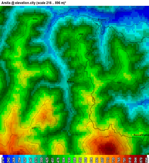
Below is the Elevation map of Arsita, which displays elevation range with different colors. Scale of the first map is from 216 to 896 m (709 to 2940 ft) with average elevation of 476.3 meters (=1563 ft) [note 1]
These maps also provides idea of topography and contour of this city, they are displayed at different zoom levels. More info about maps, scale and edge coordinates you can find below images.
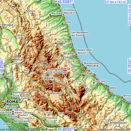
| \ | Map #1 | Topo.Map |
| Scale [m] | 216..896 m | × |
| Scale [ft] | 709..2940 ft | × |
| Average | 476.3 m = 1563 ft | × |
| Width | 7.2 km = 4.5 mi | 230.6 km = 143.3 mi |
| Height | 7.2 km = 4.5 mi | 230.5 km = 143.2 mi |
| ↑Max Latitude | 42.53505° | 43.53081° |
| Latitude at center | 42.50266° | 42.50266° |
| ↓Min Latitude | 42.470253° | 41.45732° |
| ← Min Longitude | 13.741215° | 12.37891° |
| Longitude center | 13.78516° | 13.78516° |
| →Max Longitude | 13.829105° | 15.19141° |
Nearby cities:
Cities around Arsita sort by population:
• Isola del Gran Sasso d'Italia elevation 414 m
10.5 km,  270°
270°
• Basciano 319 m
11.2 km,  338°
338°
• Cermignano 522 m
9.9 km,  4°
4°
• Cellino Attanasio 411 m
11.1 km,  33°
33°
• Bisenti 291 m
3.1 km,  21°
21°
• Colledara 417 m
9.9 km,  294°
294°
• Farindola 571 m
7.3 km,  155°
155°
• Castiglione Messer Raimondo 286 m
8.4 km,  67°
67°
• Penna Sant'Andrea 395 m
10.2 km,  354°
354°
• Castelli 593 m
6.3 km,  251°
251°
• Montefino 359 m
9.5 km,  59°
59°
• Castel Castagna 449 m
7.2 km,  308°
308°
Multilingual:
 En español:
Arsita elevación 477 m.
 En France:
Arsita élévation 477 m.


Sources and notes:
- [note 1] Map square and city borders are not equal. Map elevation data is calculated only from area inside that square.
- [src 1] Elevation data from geonames database provided with same terms of usage.
- [src 2] The elevation map of Arsita is generated using elevation data from NASA's 3 arcsec (90m) resolution SRTM data.
- [src 3] Base (background) map © OpenStreetMap contributors tiles are generated by Geofabrik and OpenTopoMap.
Copyright & License:
This Arsita Elevation Map is licensed under CC BY-SA. You may reuse any part from this page, if you give a proper credit by linking to this URL:
 More info on terms of use page.