Farindola elevation
Farindola (Abruzzo, Provincia di Pescara), Italy elevation is 571 meters and Farindola elevation in feet is 1873 ft above sea level [src 1]. Farindola is a seat of a third-order administrative division (feature code) with elevation that is 249 meters (817 ft) bigger than average city elevation in Italy.
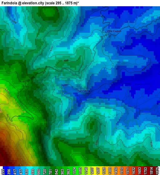
Below is the Elevation map of Farindola, which displays elevation range with different colors. Scale of the first map is from 295 to 1875 m (968 to 6152 ft) with average elevation of 654.8 meters (=2148 ft) [note 1]
These maps also provides idea of topography and contour of this city, they are displayed at different zoom levels. More info about maps, scale and edge coordinates you can find below images.
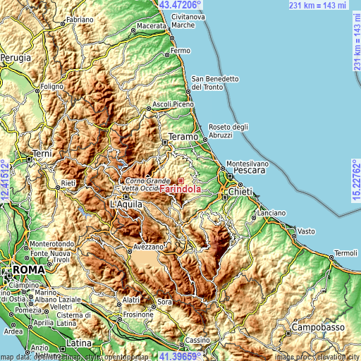
| \ | Map #1 | Topo.Map |
| Scale [m] | 295..1875 m | × |
| Scale [ft] | 968..6152 ft | × |
| Average | 654.8 m = 2148 ft | × |
| Width | 7.21 km = 4.5 mi | 230.8 km = 143.4 mi |
| Height | 7.21 km = 4.5 mi | 230.8 km = 143.4 mi |
| ↑Max Latitude | 42.475341° | 43.47206° |
| Latitude at center | 42.44292° | 42.44292° |
| ↓Min Latitude | 42.410482° | 41.39659° |
| ← Min Longitude | 13.777425° | 12.41512° |
| Longitude center | 13.82137° | 13.82137° |
| →Max Longitude | 13.865315° | 15.22762° |
Nearby cities:
Cities around Farindola sort by population:
• Penne elevation 415 m
8.8 km,  81°
81°
• Bisenti 291 m
9.7 km,  349°
349°
• Civitella Casanova 420 m
10.2 km,  149°
149°
• Castel del Monte 1345 m
11.6 km,  222°
222°
• Castiglione Messer Raimondo 286 m
11 km,  25°
25°
• Montebello di Bertona 585 m
5 km,  125°
125°
• Castelli 593 m
10.1 km,  297°
297°
• Arsita 477 m
7.3 km,  335°
335°
• Villa Celiera 728 m
7.4 km,  155°
155°
• Montefino 359 m
12.5 km,  24°
24°
• Carpineto della Nora 526 m
12.6 km,  165°
165°
• Villa Santa Lucia degli Abruzzi 872 m
12.7 km,  196°
196°
Multilingual:
 En español:
Farindola elevación 571 m.
 En France:
Farindola élévation 571 m.
 Auf Deutsch:
Farindola höhe über dem Meeresspiegel ist 571 m.

Sources and notes:
- [note 1] Map square and city borders are not equal. Map elevation data is calculated only from area inside that square.
- [src 1] Elevation data from geonames database provided with same terms of usage.
- [src 2] The elevation map of Farindola is generated using elevation data from NASA's 3 arcsec (90m) resolution SRTM data.
- [src 3] Base (background) map © OpenStreetMap contributors tiles are generated by Geofabrik and OpenTopoMap.
Copyright & License:
This Farindola Elevation Map is licensed under CC BY-SA. You may reuse any part from this page, if you give a proper credit by linking to this URL:
 More info on terms of use page.