Auditore elevation
Auditore (The Marches, Provincia di Pesaro e Urbino), Italy elevation is 359 meters and Auditore elevation in feet is 1178 ft above sea level [src 1]. Auditore is a seat of a third-order administrative division (feature code) with elevation that is 37 meters (121 ft) bigger than average city elevation in Italy.
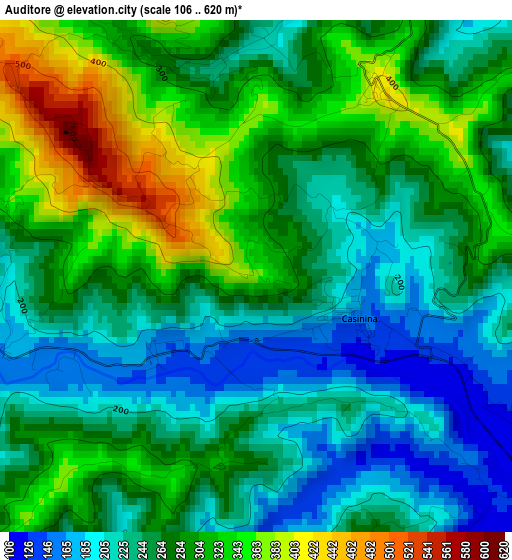
Below is the Elevation map of Auditore, which displays elevation range with different colors. Scale of the first map is from 106 to 620 m (348 to 2034 ft) with average elevation of 271.2 meters (=890 ft) [note 1]
These maps also provides idea of topography and contour of this city, they are displayed at different zoom levels. More info about maps, scale and edge coordinates you can find below images.
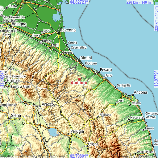
| \ | Map #1 | Topo.Map |
| Scale [m] | 106..620 m | × |
| Scale [ft] | 348..2034 ft | × |
| Average | 271.2 m = 890 ft | × |
| Width | 7.05 km = 4.4 mi | 225.6 km = 140.2 mi |
| Height | 7.05 km = 4.4 mi | 225.6 km = 140.2 mi |
| ↑Max Latitude | 43.852938° | 44.82723° |
| Latitude at center | 43.82124° | 43.82124° |
| ↓Min Latitude | 43.789525° | 42.79801° |
| ← Min Longitude | 12.527705° | 11.1654° |
| Longitude center | 12.57165° | 12.57165° |
| →Max Longitude | 12.615595° | 13.9779° |
Nearby cities:
Cities around Auditore sort by population:
• Borgo Massano elevation 89 m
8.7 km,  87°
87°
• Mercatale 237 m
8.2 km,  238°
238°
• Casinina 188 m
1.1 km,  118°
118°
• Sassocorvaro 342 m
7.2 km,  233°
233°
• Mondaino 376 m
8.8 km,  62°
62°
• Mercatino Conca 284 m
8.4 km,  310°
310°
• Tavoleto 417 m
3.1 km,  35°
35°
• Saludecio 308 m
9.4 km,  50°
50°
• Gemmano 380 m
9.2 km,  4°
4°
• Montefiore Conca 368 m
8.2 km,  22°
22°
• Montecalvo in Foglia 329 m
4.9 km,  103°
103°
• Sassofeltrio 459 m
9.3 km,  327°
327°
Multilingual:
 En español:
Auditore elevación 359 m.
 En France:
Auditore élévation 359 m.
 Auf Deutsch:
Auditore höhe über dem Meeresspiegel ist 359 m.

Sources and notes:
- [note 1] Map square and city borders are not equal. Map elevation data is calculated only from area inside that square.
- [src 1] Elevation data from geonames database provided with same terms of usage.
- [src 2] The elevation map of Auditore is generated using elevation data from NASA's 3 arcsec (90m) resolution SRTM data.
- [src 3] Base (background) map © OpenStreetMap contributors tiles are generated by Geofabrik and OpenTopoMap.
Copyright & License:
This Auditore Elevation Map is licensed under CC BY-SA. You may reuse any part from this page, if you give a proper credit by linking to this URL:
 More info on terms of use page.