Bacoli elevation
Bacoli (Campania, Napoli), Italy elevation is 2 meters and Bacoli elevation in feet is 7 ft above sea level [src 1]. Bacoli is a seat of a third-order administrative division (feature code) with elevation that is 320 meters (1050 ft) smaller than average city elevation in Italy.
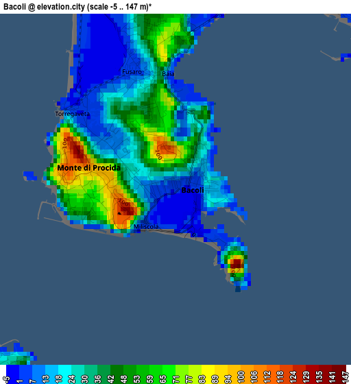
Below is the Elevation map of Bacoli, which displays elevation range with different colors. Scale of the first map is from -5 to 147 m (-16 to 482 ft) with average elevation of 33.2 meters (=109 ft) [note 1]
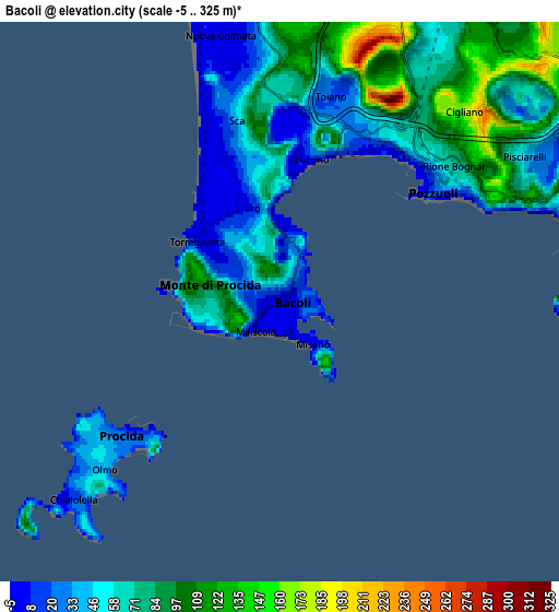
These maps also provides idea of topography and contour of this city, they are displayed at different zoom levels. More info about maps, scale and edge coordinates you can find below images.
| \ | Map #1 | Map #2 | Topo.Map |
| Scale [m] | -5..147 m | -5..325 m | × |
| Scale [ft] | -16..482 ft | -16..1066 ft | × |
| Average | 33.2 m = 109 ft | 66.5 m = 218 ft | × |
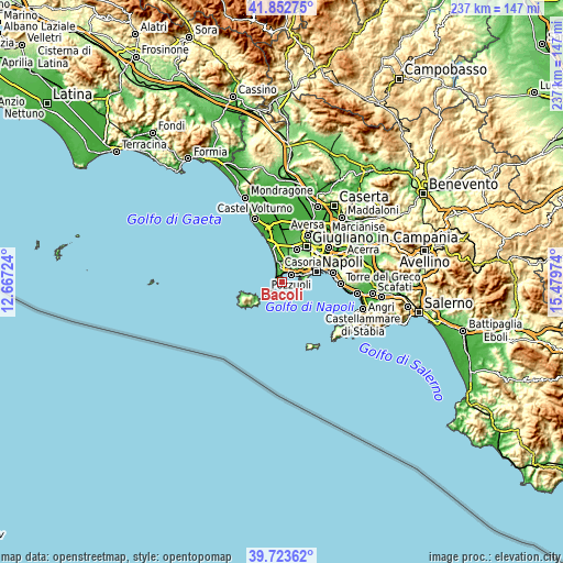
| Width | 7.4 km = 4.6 mi | 14.8 km = 9.2 mi | 236.7 km = 147.1 mi |
| Height | 7.4 km = 4.6 mi | 14.8 km = 9.2 mi | 236.7 km = 147.1 mi |
| ↑Max Latitude | 40.82998° | 40.863223° | 41.85275° |
| Latitude at center | 40.79672° | 40.79672° | 40.79672° |
| ↓Min Latitude | 40.763444° | 40.730151° | 39.72362° |
| ← Min Longitude | 14.029545° | 13.985599° | 12.66724° |
| Longitude center | 14.07349° | 14.07349° | 14.07349° |
| →Max Longitude | 14.117435° | 14.161381° | 15.47974° |
Nearby cities:
Cities around Bacoli sort by population:
• Pianura elevation 160 m
10.9 km,  50°
50°
• Pozzuoli 28 m
5.6 km,  19°
19°
• Soccavo 88 m
11.4 km,  61°
61°
• Quarto 52 m
10.8 km,  33°
33°
• Monterusciello 117 m
8 km,  5°
5°
• Bagnoli 3 m
8.2 km,  77°
77°
• Posillipo 45 m
10.8 km, 80°
• Monte di Procida 81 m
2 km,  274°
274°
• Procida 34 m
6.7 km,  227°
227°
• Amodio-Massariola 74 m
10.3 km, 8°
• Country Park 35 m
9.5 km,  2°
2°
• Masseria Vecchia Ovest 28 m
10.4 km,  356°
356°
Multilingual:
 En español:
Bacoli elevación 2 m.
 En France:
Bacoli élévation 2 m.


Sources and notes:
- [note 1] Map square and city borders are not equal. Map elevation data is calculated only from area inside that square.
- [src 1] Elevation data from geonames database provided with same terms of usage.
- [src 2] The elevation map of Bacoli is generated using elevation data from NASA's 3 arcsec (90m) resolution SRTM data.
- [src 3] Base (background) map © OpenStreetMap contributors tiles are generated by Geofabrik and OpenTopoMap.
Copyright & License:
This Bacoli Elevation Map is licensed under CC BY-SA. You may reuse any part from this page, if you give a proper credit by linking to this URL:
 More info on terms of use page.