Bisaccia elevation
Bisaccia (Campania, Provincia di Avellino), Italy elevation is 898 meters and Bisaccia elevation in feet is 2946 ft above sea level [src 1]. Bisaccia is a seat of a third-order administrative division (feature code) with elevation that is 576 meters (1890 ft) bigger than average city elevation in Italy.
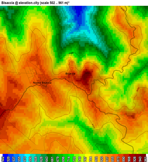
Below is the Elevation map of Bisaccia, which displays elevation range with different colors. Scale of the first map is from 502 to 961 m (1647 to 3153 ft) with average elevation of 777.4 meters (=2551 ft) [note 1]
These maps also provides idea of topography and contour of this city, they are displayed at different zoom levels. More info about maps, scale and edge coordinates you can find below images.
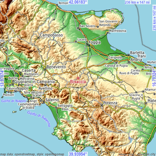
| \ | Map #1 | Topo.Map |
| Scale [m] | 502..961 m | × |
| Scale [ft] | 1647..3153 ft | × |
| Average | 777.4 m = 2551 ft | × |
| Width | 7.37 km = 4.6 mi | 236 km = 146.6 mi |
| Height | 7.37 km = 4.6 mi | 236 km = 146.6 mi |
| ↑Max Latitude | 41.042383° | 42.06183° |
| Latitude at center | 41.00923° | 41.00923° |
| ↓Min Latitude | 40.97606° | 39.93954° |
| ← Min Longitude | 15.333045° | 13.97074° |
| Longitude center | 15.37699° | 15.37699° |
| →Max Longitude | 15.420935° | 16.78324° |
Nearby cities:
Cities around Bisaccia sort by population:
• Calitri elevation 692 m
9.6 km,  166°
166°
• Rocchetta Sant'Antonio 612 m
12.6 km,  33°
33°
• Lacedonia 728 m
5.9 km,  39°
39°
• Bisaccia Nuova 874 m
1.8 km,  271°
271°
• Vallata 851 m
10.9 km,  288°
288°
• Aquilonia 754 m
8.6 km,  106°
106°
• Andretta-Mattinella 806 m
9.1 km,  208°
208°
• Scampitella 781 m
11.3 km,  325°
325°
• Monteverde 712 m
13.2 km,  95°
95°
• Vallesaccarda 667 m
12.1 km,  299°
299°
• Trevico 1061 m
12.8 km, 289°
• Cairano 745 m
12.7 km,  182°
182°
Multilingual:
 En español:
Bisaccia elevación 898 m.
 En France:
Bisaccia élévation 898 m.
 Auf Deutsch:
Bisaccia höhe über dem Meeresspiegel ist 898 m.

Sources and notes:
- [note 1] Map square and city borders are not equal. Map elevation data is calculated only from area inside that square.
- [src 1] Elevation data from geonames database provided with same terms of usage.
- [src 2] The elevation map of Bisaccia is generated using elevation data from NASA's 3 arcsec (90m) resolution SRTM data.
- [src 3] Base (background) map © OpenStreetMap contributors tiles are generated by Geofabrik and OpenTopoMap.
Copyright & License:
This Bisaccia Elevation Map is licensed under CC BY-SA. You may reuse any part from this page, if you give a proper credit by linking to this URL:
 More info on terms of use page.